Hello, this is Uchiyama of the Stroly development team.
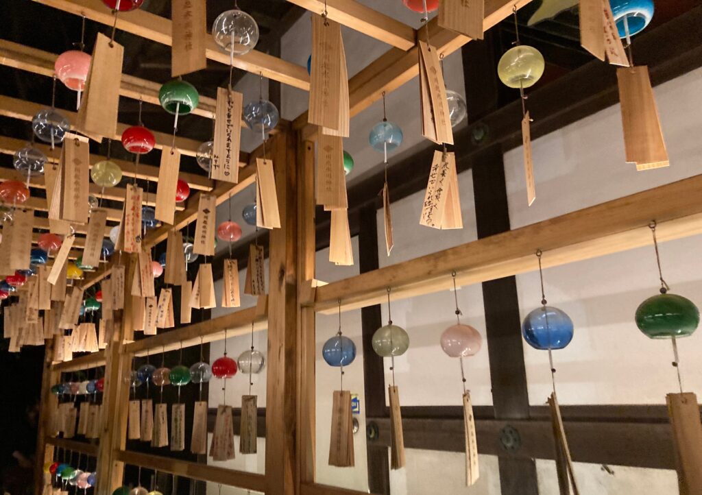
The other day, while the Sumida River Fireworks Festival was being held in Tokyo, I was at the Kawagoe Hyakumantou Summer Festival.
The photo is of Kawagoe Hikawa Shrine. The wind chimes were ringing and I thought it was cool, but I don’t think the heat was that different.
I enjoyed the summer air.
Update information for Stroly Viewer v14.3.0
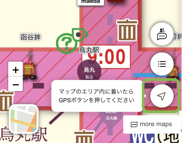
GPS can now be activated even when you are out of the area on the map.
When the GPS button was pressed, if the acquired location information (current location) was outside the range of the map, the GP S was stopped once. Therefore, if you wanted to display your current location on the map, you had to enter the map area and then press the GPS button again.
Now you can press the GPS button at any time. If you are out of range of the map, pressing the GPS button will activate the GPS, and once you are within range of the map, your current location will be displayed on the map without you having to do anything.
From now on, we hope that you will press the GPS button whenever you like.
In addition, this support has made switching between the illustration map and the standard map smoother. Previously, there was loading when switching between the two maps, which made the transition a little sluggish, but now the switch is instantaneous and stress-free. Please try it out and see how it feels.
Update information for StrolyCom v6.18.0
OpenStreetMap display in the map editor now matches the viewer
We recently changed the design of OpenStreetMap displayed in the map editor to match that of the viewer.
However, the text size and other features in the Map Editor were displayed larger than in the Viewer.
In this release, we have adjusted the appearance of the editor and viewer to match, including the font size.
The reduced difference between the editor and viewer makes map editing easier, and we hope you will take this opportunity to create your own original maps.
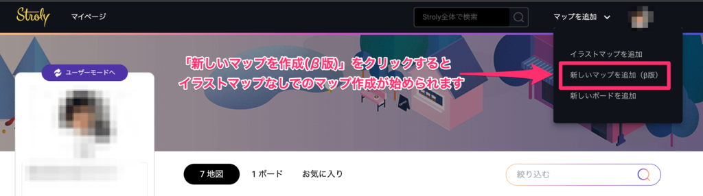
Currently, Stroly provides a function that allows users who do not have an illustration map to create a map of recommended spots.
Please try to create a map without an illustration map by clicking “Add New Map (beta version)” from the menu in the upper right corner of My Page.
At Stroly, we are committed to developing new features and improving functions every day in order to provide a thrilling user experience. Please look forward to the next release.
Our entire staff is looking forward to hearing from all of you, our users.