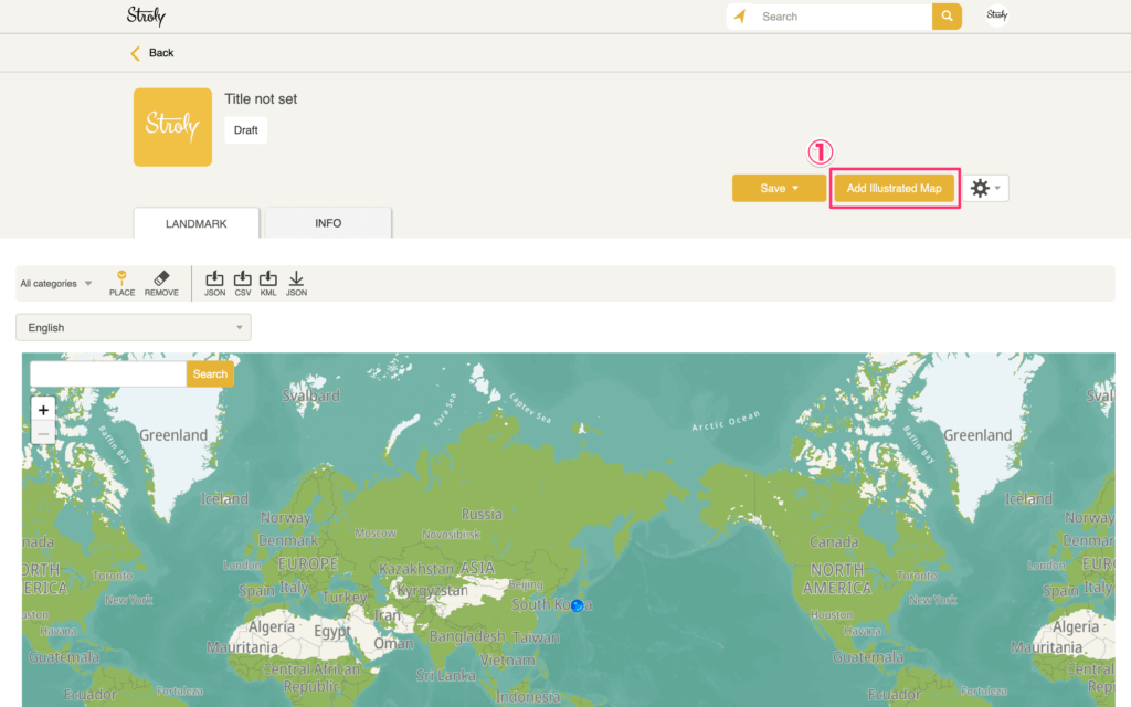
On My Page, click “Add map” > “Upload new map” in the upper right corner. Or go to the editor page.
Prepare your illustrated map and follow the steps below.
1.Click “Upload new map” and select the illustration map to upload.
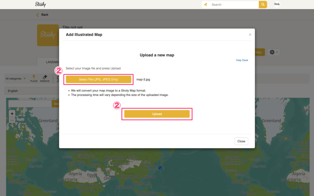
2.After clicking “Select file” and selecting the illustration map to upload,Click “Upload” to upload the illustrated map.
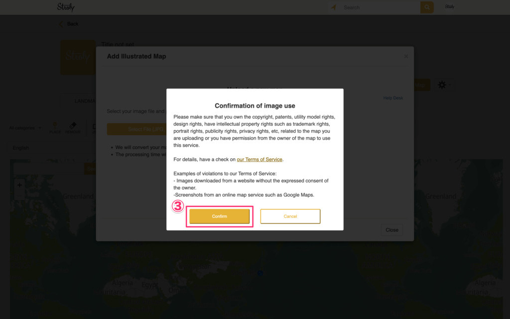
3.Read the message on “Confirmation of Image of Use” and click “Confirm” to continue.
4.The upload will start, and after a while you will be redirected to the page where you can align the map.
5.Add mapping points using “MAPPING”. Once aligned, you can go to “LANDMARK” and add spot pins.
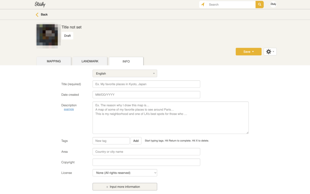
In “INFO”, you can set the title of this map.
You can’t publish your map unless you add mapping points to the map.
※Check here for more information about this page.