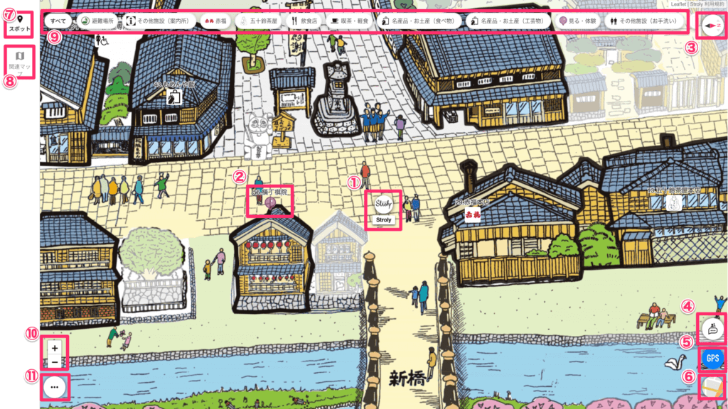
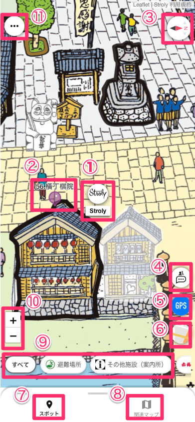
This section explains the basics of how to use Viewer.
1.Character
Your character is displayed in the center of the map.
In solo mode, your character will appear when you enter an area on the map and click the GPS button.
Your character will always be visible while you are using the room.
2.Spots
Here are the icons that indicate spots.
Tap a pin on the map to open spot information and display the introduction text.
3.Compass button
The compass indicates the direction of the map’s center.
Also, pressing this button toggles the map rotation function ON/OFF.
Map rotation can be done by touching the smartphone screen with two fingers and rotating them.
If you press the compass button while the illustration map is rotating, the map rotation will return to its initial state.
Pressing the compass button in this state will rotate the illustration map with the top of the screen facing north.
If you press the compass button while the standard map is rotating, the standard map will rotate with the top of the screen facing north.
4.Chat
The chat function allows you to communicate with other users participating in group mode.
The chat screen also displays other characters on the same map.
*Only displayed when using group mode.
5.GPS button
This button displays your current location on the map.
In group mode, pressing the button displays a confirmation window, and by granting permission, you can share your current location with other users.
6.Map switch button
This button toggles between the illustration map and the standard map.
When the standard map is displayed, the map selected in the setting button’s map switch destination is displayed.
7.Spot List
You can check the spots displayed on the map in a list for each category.
8.Related Maps
Clicking this will display the maps that belong to the same group as the current map.
9.Category List
A list of categories is displayed.
When you select a category, only the spots included in the selected category are displayed on the map. Multiple categories can be selected.
10.+ー button
These buttons are used to zoom in and out on the map.
11.Settings button
Clicking this will display items such as language settings and map switch destinations.