At Stroly, we call “mapping” for matching the illustrated map to the actual location information. It is the process of aligning the uploaded illustrated map with the standard map.
Specifically, by registering multiple corresponding points (mapping points) on the illustrated map and the standard map, the illustrated map will show the current location when published.
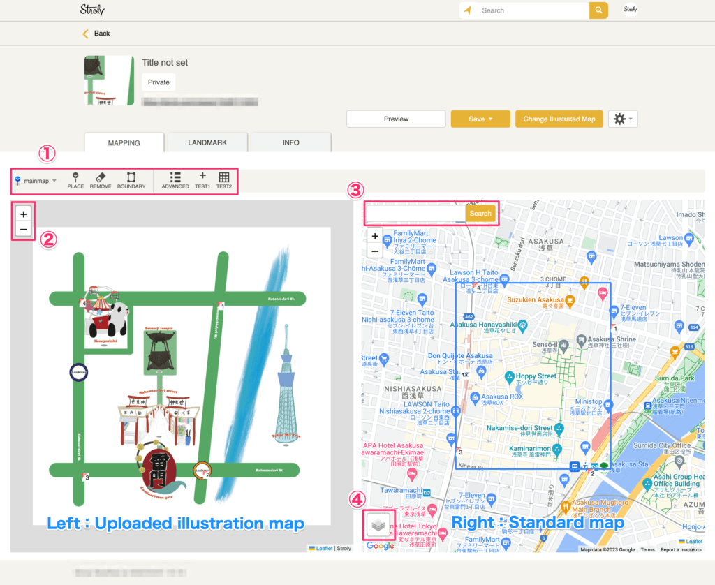
1.Menu panel: Use this button to add or delete mapping points.
The button in use will change to orange.
2.Zoom in/out button: You can zoom in/out on the illustrated map and standard map.
3.Search: Enter a name of a place and click “Search” to find the area you are looking for.
4.You can switch between Google Maps, standard map, digital land map (Japan only), and satellite map.
Setting boundaries on your map
This is a function to align the area of the illustrated map with the area of the standard map.
Normally, you don’t need to worry about it; the entire area uploaded will be registered for the illustrated map, and the aligned area will be registered automatically for the standard map.
When do I use this function?
Use this function when you’re registering more than a single area for mapping, such as an enlarged area within a map or multiple regions drawn in a map.