Japan (1905)
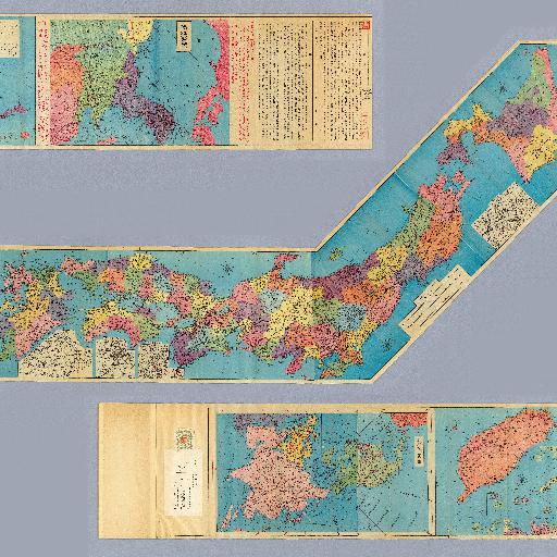
1 atlas : 4 col. maps ; 25 cm. Cover title. Lithograph. In Japanese and English. Orientation varies. Relief shown by hachures and spot heights. Includes distance charts, charts of mountains, rivers, lakes on verso. Includes preface and legend. East Asian Library call number: Cb153.
All spots information
0 spots