世界地図 (1736)
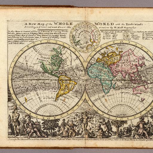
<html> <body>Hand col. engraved double-hemisphere map. Includes note on trade winds, inset of the Arctic, table of signs of the Zodiack, and ill. Shows California as an island. </body> </html>
すべてのスポット情報
0件のスポット
<html> <body>Hand col. engraved double-hemisphere map. Includes note on trade winds, inset of the Arctic, table of signs of the Zodiack, and ill. Shows California as an island. </body> </html>
0件のスポット