Paris (1716)
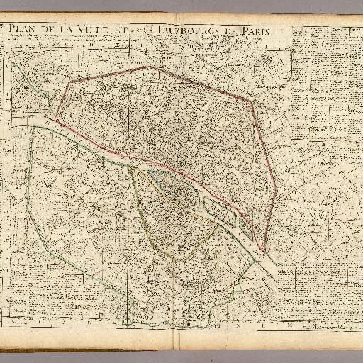
<html> <body>From Mary Pedley regarding the map date: Jean Boutier, Les plans de Paris, 2nd ed. 2007, no. 185, pp 224-225: suggests that addition of "Ier geogr[aphe] du roi" a title Delisle received in 1718 would put the date of this map, a second edition, at 1720. Boutier is the best source for Paris maps prior to 1800. Engraved map in outline color. Shows selected named buildings (some in perspective), gardens, fields. Includes "Table alphabetique des rues de la Ville et Faubr. de Paris." Scale in toises parisienes. </body> </html>
All spots information
0 spots