California (1885)
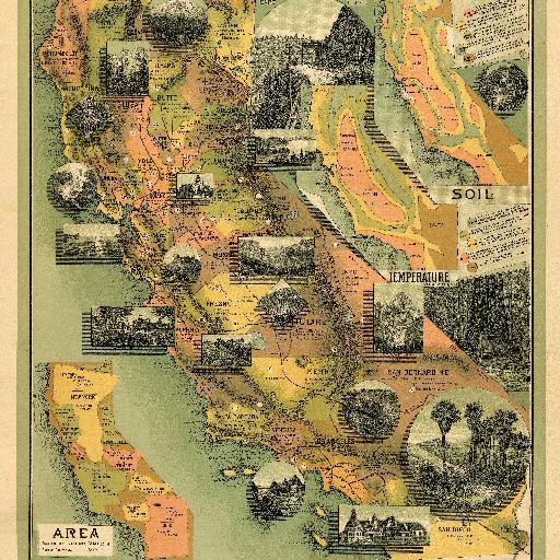
The date is estimated from the county formation (San Benito and Del Norte). This is a remarkable map with twenty vignettes of California scenes and three inset maps showing soil, temperature, and areas. Another inset shows the heights of the Sierra Nevada mountains. All these elements combine to make a beautiful map. Little is know about the maker, Johnstone, except that he drew the Climatic Map of California as well (see our #941). Printed in full color.
All spots information
3 spots