USA (1929)
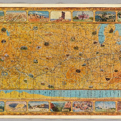
Map in full color with drawings of interesting features in the United States. Below the main map is an elevation profile with lines leading up to the point along the route noted below. The profile delineates the states, mileage and the height of the features on the profile. The route of the airplane is shown in blue and includes an airplane making the trip. Surround the map and profile are drawings of natural features and cities throughout the United States.
All spots information
0 spots