The Main Line: A Historical map of Ye Outlying Regions
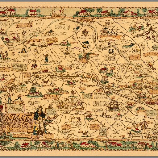
Pictorial map, mounted on board 74x82, depicting the geography, history and landmarks of the Main Line, western suburbs of Philadelphia, Pennsylvania. Shows rail line, counties, towns, major roads, landmarks, rivers and streams. Title cartouche shows a pair of Native Americans from the Lenape tribe on one side and George Washington on the other. The compass rose is created from the intersection of an arrow and a tomahawk with a rifle and a sword. Include numerous illustrations with descriptive text showing history of the region related to the Colonial era and the Revolutionary War, and locations of important events and brief biographies of historical figures. Border around the map are vignettes of detailed drawings of historic buildings and people.
All spots information
0 spots