Carte d'Europe. Editions Jacque-Petit, Angers - France - 1946
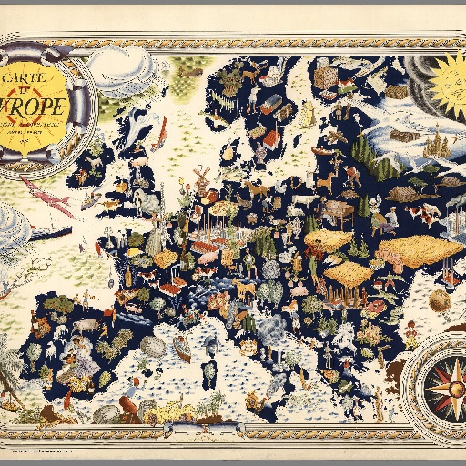
Very decorative large pictorial map of Europe designed in 1946 by Pierre Herault and published in Angers by Editions Jacques Petit in 1955. The separately issued map shows the whole of Europe without national borders and it is richly illustrated by nice illustrations featuring people, flora, animals, farms, gastronomic delight of the various countries. In the top right corner, a smiling sun gives a new bright optimism to the continent after the 6 years of conflict. A very nice uncommon map.
All spots information
0 spots