
All spots information
33 spots
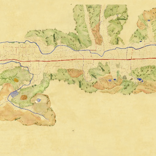
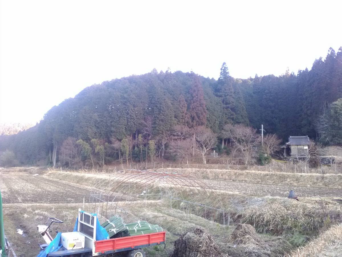
 Road
Road

The Giant Japanese Cedar of Yasuda is a giant tree with a diameter at eye level of 8.5 meters and a height of around 31 meters. It is supposed that its estimated age is 700 to 800 years, and it completely covers the shrine grounds of Kifune Daimyojin. It is also called "Jinshichi Forest" as it looks like a forest when seen from a distance. It is located at the entrance of the post town, Fukusumi, and it is popular as a local symbol (prefecture-designated natural monument). Location:Yasuda

In the Sasayama Domain, along with constructing a castle, soil was piled up and a pine was planted every Japanese ri (approximately 3.9 km) as markers alongside Saikyo Road with the front gate of the castle being the base point. This Ichirizuka marker of Fukusumi is the one on the third ri. The pines planted now have been newly planted and convey the scenery of Fukusumi, the post town alongside the highway, to present day. Location:Fukusumi

Nose Road is an old road that is also called "Tanshu Road," etc., and at present it is almost overlapping with National Route 173 and ends here in Fukusumi. This Nose Road that stretches from the south side and Saikyo Road that goes through east and west intersect at Fukusumi, and it can be seen that it was an important position for traffic. Location:Fukusumi
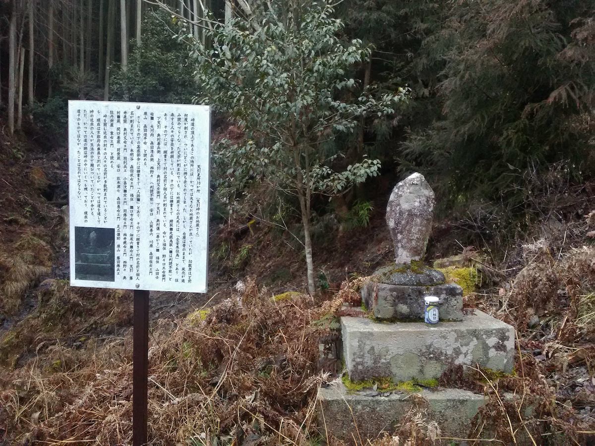
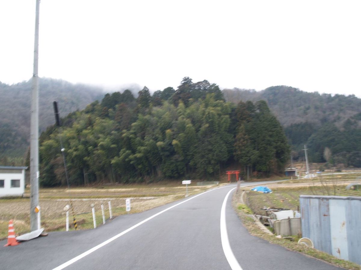
Amabiki Mountain Pass is a road that connects Kyoto with the San'in Region and was the eastern entrance to enter the Fukusumi area. In present day, the Amabiki Tunnel has been opened, and the old road cannot be entered. A Jizo statue that prays for traffic safety stands on top of the pass. It was said that there was once an inn called "Botamochiya," which lodged travelers and fed them botamochi. Location:Nishinono
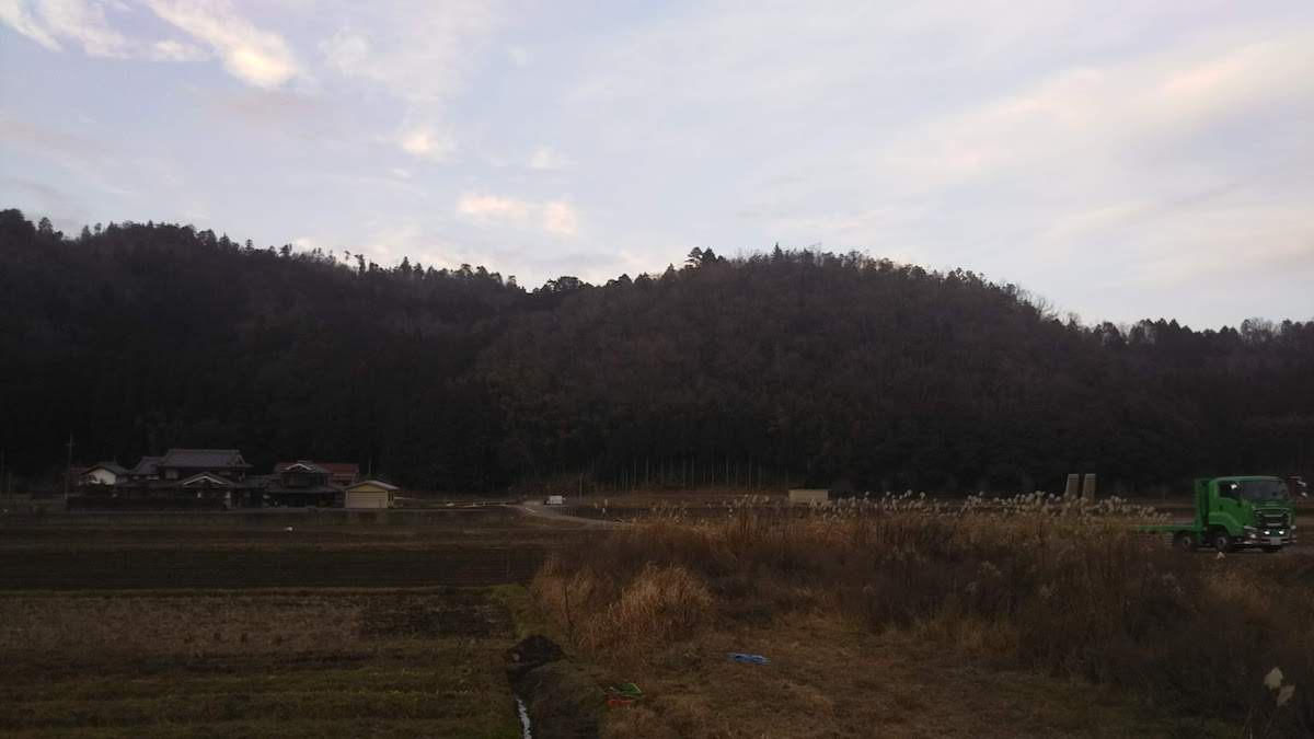
Saikyo Road
![]() Road
Road
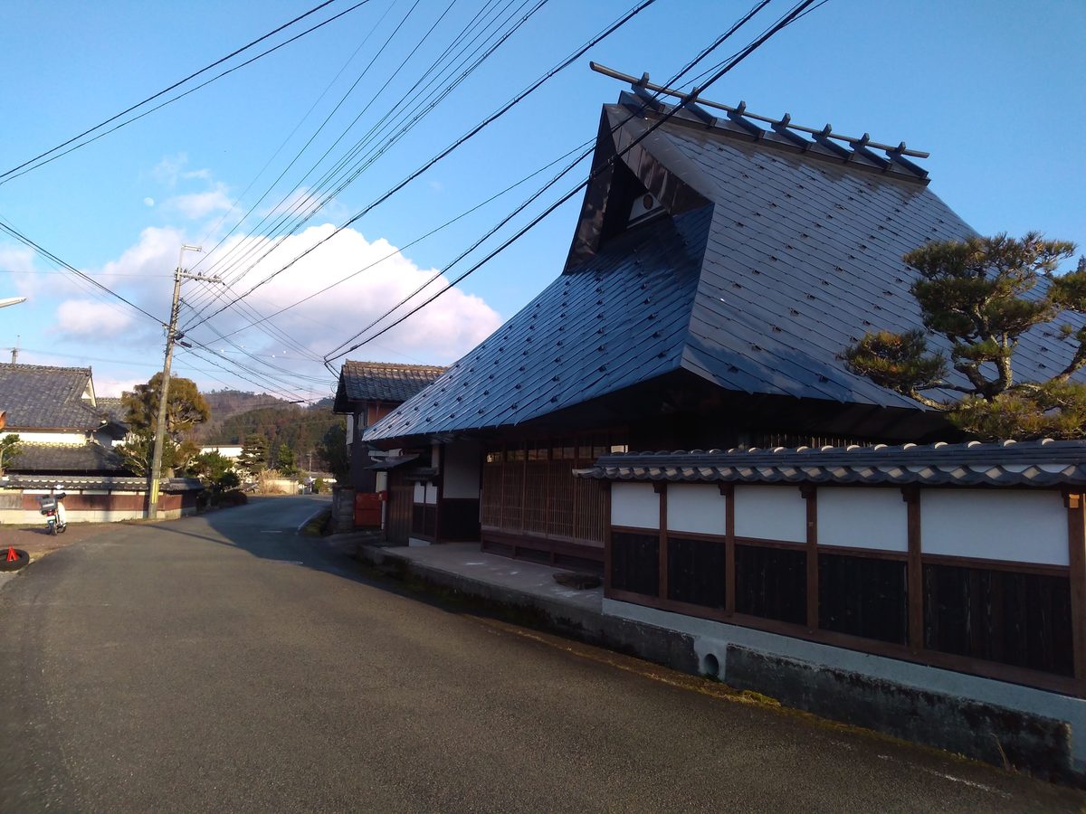
Saikyo Road is an old road that is also called "Sasayama Road," "San'in Path," "San'in Road," "Kyo Road," etc. The Saikyo Road in Taki County (which is almost where Sasayama City is now) stretches east with Sasayama Castle as the starting point and heads toward Kyoto over the Amabiki Mountain Pass. The Fukusumi area prospered as a post town located on Saikyo Road in the Edo period. Location:Fukusumi
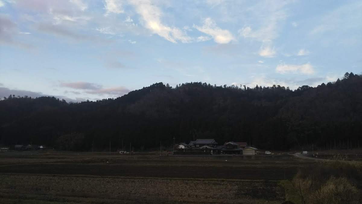
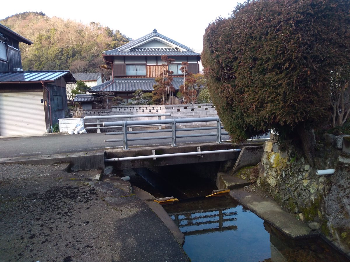
 Place・Festival
The name of Kawara (which can mean "river plain") is thought to have originated from the area once being alongside the Momii River that flows on the north side. Its characteristics are houses that are not closely grouped together, with main buildings being arranged back from the road, and fields existing between the front gardens and houses. Sumiyoshi Shrine, which is said to have had its deity divided from that of the Sumiyoshi Grand Shrine of Osaka, has become the symbol of this area. In the 24th year of the Heisei period (2012), the Fukusumi area including Kawara was selected as an Important Preservation District for Groups of Historic Buildings of the country. 〇The "Kikusui Float," the Hikiyama Float of Kawara The "Kikusui Float" is the hikiyama float that is pulled in the Minazuki Festival, which is a festival of Sumiyoshi Shrine, and the miokuri (the kesohin tapestry decorating the rear of the hikiyama float) is of Urashima Taro. The shape of the float that imitates a Yakatabune house boat expresses that Sumiyoshi no Okami is a sea deity, and the procession of musical accompaniments express the sound of waves with drums and fire bells. Location:Kawara
The name of Nishinono (which can mean "West Plains") originates from it being to the west of Honme Village, Kuwada County (now Kameoka City in Kyoto). In the Edo period, it was the Kameyama Domain (now Kameoka City). Its characteristics are fields that exist between the houses, with empty gaps between each house and fields spreading out between the houses. In the 24th year of the Heisei period (2012), the Fukusumi area including Nishinono was selected as an Important Preservation District for Groups of Historic Buildings of the country. Location:Nishinono
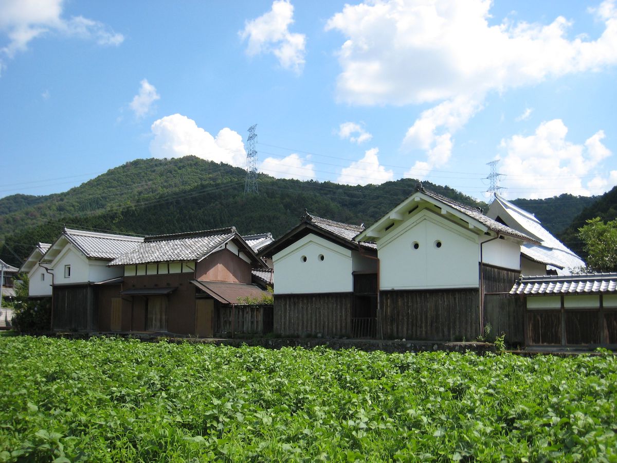
The name of Hadakasu originated from the large number of Japanese giant salamanders that lived there, which were called hadakasu in this region. The kanji characters for the name, which can be pronounced as "anko," were placed from hadakasu being similar to anglerfish, which are also called "anko." In the Edo period, it was the Kameyama Domain (now Kameoka City). There are not many houses of the town house type, and characteristics of a rural community have been stongly left behind. In the 24th year of the Heisei period (2012), the Fukusumi area including Hadakasu was selected as an Important Preservation District for Groups of Historic Buildings of the country. In the Edo period, it was the Kameyama Domain and formed the boundary between it and the Sasayama Domain. Location:Hadakasu
Fukusumikami
![]() Place・Festival
Place・Festival
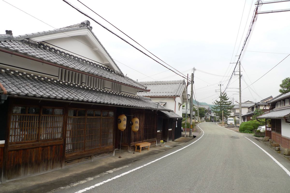
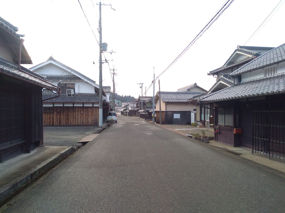
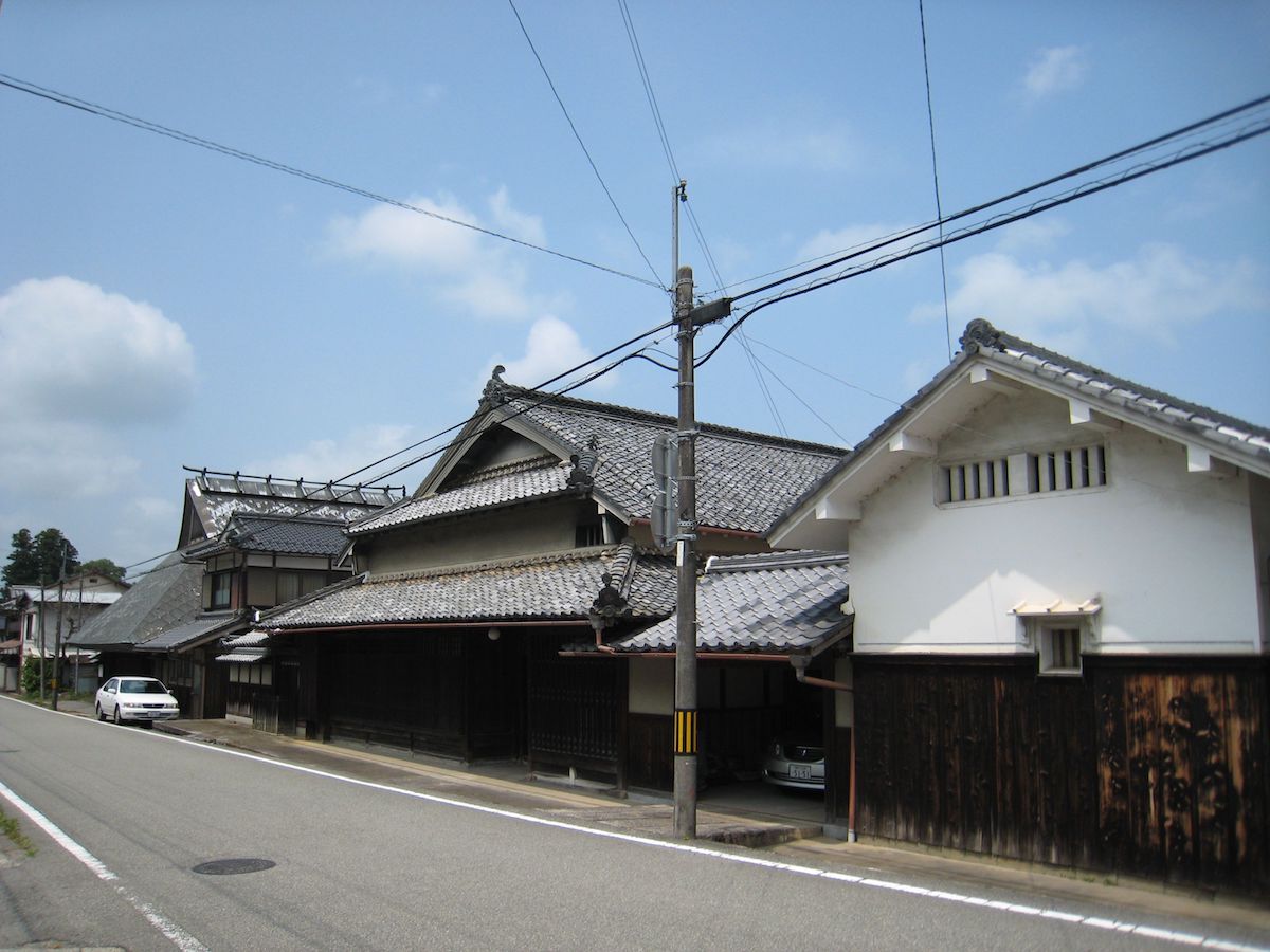
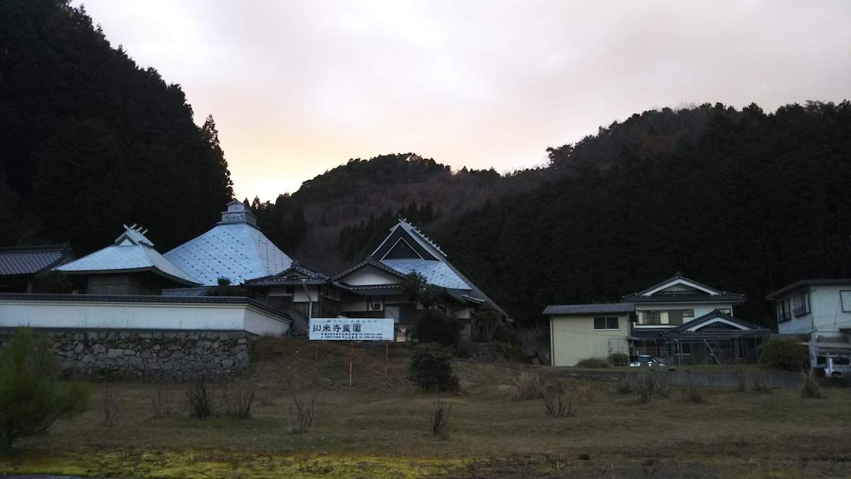
Fukusumi was also referred to as "Fukuzumi" in olden times. There exist historical materials in the Muromachi period where the mention of "Fukusumi" is written. Many traditional buildings centered around the Tsumairi style have been left in Fukusumikami, and it forms a historical scenery where it is combined with Ichirimatsu pines, etc. In the Edo era, it was designated to be a post town and prospered. Due to the townscape of what used to be a post town being transmitted to present day, the Fukusumi area including Fukusumikami was selected as an Important Preservation District for Groups of Historic Buildings of the country in the 24th year of the Heisei period (2012). 〇The "Tsuruju Float," the Hikiyama Float of Fukusumikami The "Tsuruju Float" is a hikiyama float that is pulled in the Minazuki Festival, which is a festival of Sumiyoshi Shrine, and it has a miokuri (the kesohin tapestry decorating the rear of the hikiyama float) of a crane and a miokuri of a dragon. The Uchikomi Bayashi (the festival music played in the Minazuki Festival) of Fukusumikami is said to express the sight of a crane leaving its nest and taking flight. Location:Fukusumikami
Fukusuminaka
![]() Place・Festival
Place・Festival
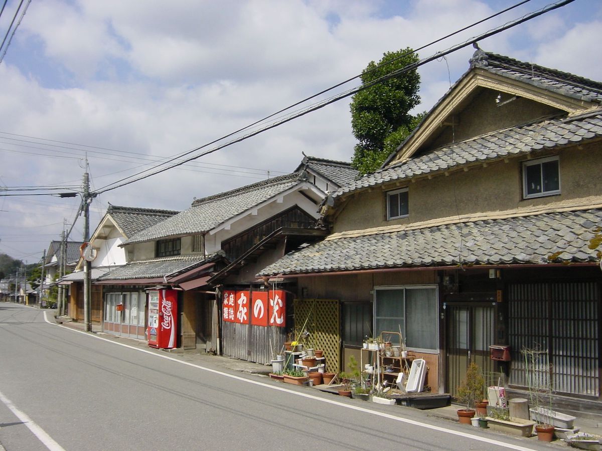
Fukusumi was also referred to as "Fukuizumi" in olden times. There exist historical materials in the Muromachi period where the mention of "Fukusumi" is written. There are groups of traditional buildings centered around the Tsumairi style in Fukusuminaka, and they come together with the waterways that flow at the sides of the buildings and with the stonework to form a historical scenery. In the Edo era, it was designated to be a post town and prospered. Due to it transmitting to the present day the traces of a post town with many Tsumairi style houses lined up together, the Fukusumi area including Fukusuminaka was selected as an Important Preservation District for Groups of Historic Buildings of the country in the 24th year of the Heisei period (2012). 〇The "Shishio Float," the Hikiyama Float of Fukusuminaka The "Shishio Float" is a hikiyama float pulled in the Minazuki Festival, which is a festival of Sumiyoshi Shrine. The miokuri (the kesohin tapestry decorating the rear of the hikiyama festival float) is of a powerful lion shown with gold and silver thread, and it is a hikiyama float with beautiful crab-shaped peony paper lanterns that glow in the night sky. Location:Fukusuminaka
Fukusumishimo
![]() Place・Festival
Place・Festival

Fukusumi was also referred to as "Fukuizumi" in olden times. There exist historical materials in the Muromachi period where the mention of "Fukusumi" is written. Fukusumishimo was located in the entrance of the post town, Fukusumi, which went alongside and connected with Saikyo Road, and in the Edo period, it was designated to be a post town and prospered. Due to it transmitting to the present day the traces of a post town with many Tsumairi style houses lined up together, the Fukusumi area including Fukusumishimo was selected as an Important Preservation District for Groups of Historic Buildings of the country in the 24th year of the Heisei period (2012). 〇The "Tortoise Shell Float," the Hikiyama Float of Fukusumishimo The "Tortoise Shell Float" is a hikiyama float that is pulled in the Minazuki Festival, which is a festival of the Sumiyoshi Shrine, and the miokuri (the kesohin tapestry decorating the rear of the hikiyama float) is of Urashima Taro riding a turtle. It is said to express the wish for perpetual youth and longevity like that of a tortoise and to express that Sumiyoshi shrine worships a sea deity. It is stated to have been made at around the end of the Edo period, and the high level of technique of the artisans at the time can be seen from it being built without using a single nail. Location:Fukusumishimo
Minazuki Festival
![]() Place・Festival
Place・Festival
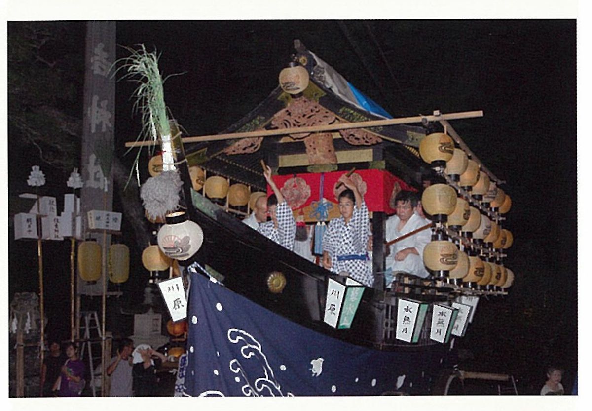
The Minazuki Festival is a festival of Sumiyoshi Shrine held every year at the end of July. When the five hikiyama floats of each village (Fukusumishimo, Fukusuminaka, Fukusumikami, Kawara, Honmyodani) have returned to the shrine (miyairi), a festival music called "Uchikomi Bayashi" is performed competitively in the shrine grounds. The people doing the uchikomi that perform the "Uchikomi Bayashi" work on practice from around fifteen years of age, and it is said that it takes up to three years to learn a single instrument. This competitive performance of Uchikomi Bayashi is the highlight of the Sumiyoshi Shrine Festival (city-designated intangible folk-cultural property). Location:Kawara 270 The State of the Minazuki Festival:https://videotube.sasayama.jp/dtl.php?VID=566 (Link: Sasayama City Audio-Visual Library)
 Temple・Shrine
Zensho-ji Temple
![]() Temple・Shrine
Temple・Shrine
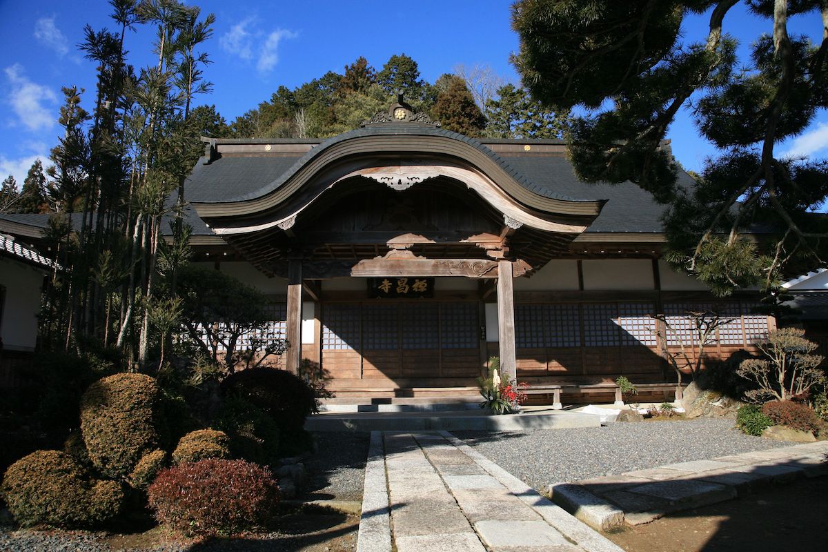
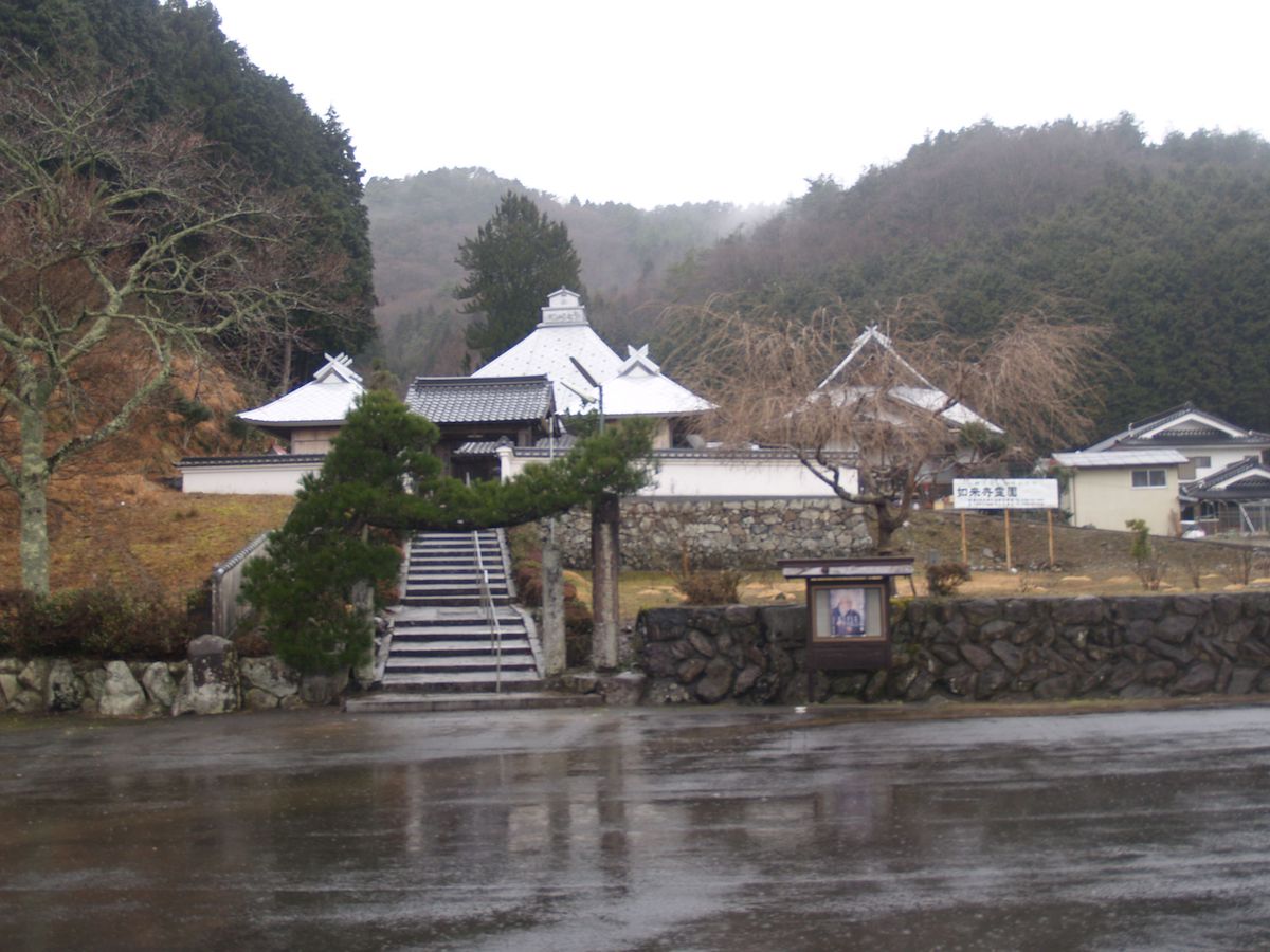
Zensho-ji Temple was founded in the years of the Tensho era and is thought to have been a place of prayer of the Momii Clan that served Hideharu Hatano, the Sengoku daimyo who ruled Taki County (which is almost where Sasayama City is now). In the seventh year of the Tensho era (1579), it was burned down due to Mitsuhide Akechi's attack on Tanba. It was rebuilt in the years of the Kan'ei era (1624-1643) and in the years from the fourth year of the Horeki era to the years of the An'ei era (1754-1773). Location:Fukusumi 274
Gokuraku-ji Temple (Daishido Hall)
![]() Temple・Shrine
Temple・Shrine
Gokuraku-ji Temple is a Buddhist temple that enshrines Kobo Daishi (Kukai), and it is said that in the past, Bon dances by the Yamashina chorus were held and many people participated from neighboring Kyoto. The entrance of the path that goes into Daishido Hall has a stone marker that was placed in the 12th year of the Taisho period (1923), and on it is carved, "Kobo Daishi Inner Sanctuary in the Eighty-Eight Places of Taki." Access is prohibited. Location:Nishinono 302
Matsunomori Shrine (Matsunomori Tenmangu Shrine)
![]() Temple・Shrine
Temple・Shrine
Matsunomori Shrine is a shrine that was constructed around 200 hundred years ago as a branch shrine of Kitano Shrine of Kyoto, and it has Sugawara no Michizane as its enshrined deity. A ceremony is held once a year. It was also the place where there was a branch school of Fukusumi Elementary School from the eighth year of the Meiji period (1876) to the 39th year of the Showa period (1964). It is a shrine with a distinctive entrance to the main shrine with towering giant trees. Location:Nishinono 541
Yamagami Shrine
![]() Temple・Shrine
Temple・Shrine

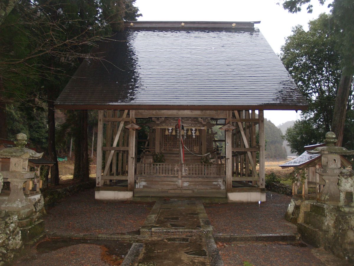
Yamagami Shrine is where Ooyama Zumikami is enshrined, and every year on January 9th, an annual festival praying for the security of the townspeople and for an abundant harvest is held. Ooyama Zumikami is a deity that appears in Japanese myth, and Yamagami Shrine is the deity's head shrine, and is located in what is now Imabari City, Ehime Prefecture. One theory states that its foundation goes back to the time period of Emperor Nintoku. Shrines that enshrine Ooyama Zumikami are distributed throughout the whole of Japan, and this Yamagami Shrine is one of them. Access is prohibited. Location:Kawara 6
Mitoshiro Shrine
![]() Temple・Shrine
Temple・Shrine

Mitoshiro Shrine is a shrine that has Emperor Ankan as its main enshrined deity, and an annual festival is held once a year to pray for the safety of the townspeople and for an abundant harvest. As its name suggests (the "to" in "Mitoshiro" means "sword"), it is said to enshrine the sword of the Imperial family. It is said that long ago when disease spread in Kawara, the disease was cured after dividing the deity from the Sanno Shrine in Shiga Prefecture and enshrining it. It is familiar to the local area, and the locals call it "Sanno Shrine." Access is prohibited. Location:Kawara 39
Sumiyoshi Shrine
![]() Temple・Shrine
Temple・Shrine
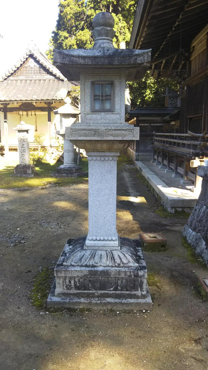
Sumiyoshi Shrine is said to have had its deity divided from the Sumiyoshi Shrine in Osaka by Masafusa Ooeno, the provincial governor of Tanba Province, in the first year of the Eiho era (1081). Sumiyoshi no Ookami is known as a deity of sea voyage safety, agriculture and industry and waka poetry, and in the past, influential people of the time such as the Momii Clan that served Hideharu Hatano, the Sengoku daimyo who ruled Taki County (which is almost where Sasayama City is now), and the successive feudal lords of the Sasayama Domain received protection from the deity. (1)The Bell Tower The bell tower of Sumiyoshi Shrine was donated by Yasunobu Matsudaira, the fourth feudal lord of the Sasayama Domain, in the second year of the Kanbun era (1662). It is an excellent tower even among the bell tower buildings in the city (city-designated cultural property). (2)Stone Lanterns There are four stone lanterns of Sumiyoshi Shrine placed in front of the hall of worship, and they have been designed by Masataro Kawakatsu, a leading expert on stone art research. They follow the style of the Kamakura period. Location:Kawara 270
Maruyama Inari Shrine
![]() Temple・Shrine
Temple・Shrine
Maruyama Inari Shrine has been said to have been invited from Fushimi Inari in Kyoto in the years of the Bun'ei era (1521-1526). After that, it was burned down and was rebuilt in the 21st year of the Meiji period (1888). It is a shrine on top of a small mountain with a red torii gate as a marker. Location:Fukusumikami
Nyorai-ji Temple
![]() Temple・Shrine
Temple・Shrine
Nyorai-ji Temple was founded in the second year of the Eiho era (1082), and it became a place of prayer of the Momii Clan which served Hideharu Hatano, the Sengoku daimyo who ruled Taki County (which is almost where Sasayama City is now), but it was burned down due to the disturbances of war in the sixth year of the Tensho era (1578). After that, it was rebuilt in the second year of the Kan'ei era (1625). At around May, the Chinese peonies and tree peonies bloom beautifully. Location:Fukusumi 607
Fukusumi Inari Shrine
![]() Temple・Shrine
Temple・Shrine
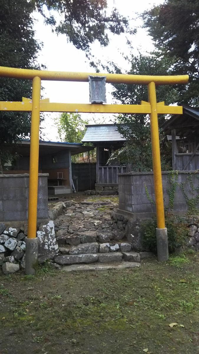
Fukusumi Inari Shrine has Ugano Minotama as its enshrined deity, and a festival called Ohitaki is held once a year. At the time of the annual festival, the Shinto priests also attend and each house makes an offering of festive red rice and deep-fried tofu at their door. It is a shrine with a distinctive yellow toriii gate. Location:Fukusumi Jijishu 188
 Historic
Nishinono Castle Ruins
![]() Historic
Historic
Nishinono Castle, also called Nishinono Fortress, refers to the ruins of a castle in the Middle Ages located in the most eastern edge of Taki County. It is said that the Nishimura Clan, a family of the Omi Sasaki Clan, had it as their base in the years of the Eiroku era (1558-1570). Location:Nishinono
Hadakasu Castle Ruins
![]() Historic
Historic
Hadakasu Fortress was a mountain castle where Tsunashige Momii was the castle lord in the Sengoku period. Tsunashige's wife was the younger sister of Hideharu Hatano, the Sengoku daimyo who ruled over Taki County (which is almost where Sasayama City is now). Tsunashige gave the family headship over to his son, Tsunatoshi, and moved from Momii Castle, which was where he had been up until that time, to Hadakasu Castle in the years of the Genki era (1570-1573). This castle was thought to have been constructed to be prepared for an invasion of Tamba by the Oda Clan, and it fell due to Mitsuhide Akechi invading in the fifth year of the Tensho era (1577). Furthermore, it is said that Tsunashige and his grandchild, Yoshitaka Tarozaemon, escaped to Kyoto. Location:Hadakasu
Hadakasu West Fortress Ruins
![]() Historic
Historic
Hadakasu West Fortress was a mountain castle constructed in the Sengoku period, and it is said that the castle lord was Ukon Shiraishi, but it can also be thought to have had a relation with the Momii Clan as well. It was made a supporting castle of Hadakasu Castle and fell due to Mitsuhide Akechi attacking Tamba. Location:Kawara
Momii Castle Ruins
![]() Historic
Historic

Momii Castle is a mountain castle that was constructed in the years of the Eisho era (1504-1521) by Terutsuna Momii. It is said that the Momii Clan has its origin in the Omi Sasaki Clan, which have the Minamoto Clan as their ancestor. They followed the Hatano Clan, the Sengoku daimyos that ruled Taki County (which is almost where Sasayama City is now), and it was said that they were feared as the blue demon of Tamba. The castle received a fierce attack when Mitsuhide Akechi invaded Tanba in the fifth year of the Tensho era (1577), and it is said that the castle lord, Momii Tsunatoshi committed suicide. Location:Honmyodani
Sekisho River
![]() Historic
Historic
The ruins of a checkpoint (called a "sekisho") that managed the comings and goings of people. The Fukusumi area in the Edo period was divided into the Sasayama Domain (now Sasayama City) and the Kameyama Domain (now Kameoka City), and when going beyond the Domain and coming and going from it, there was a need to pass through the checkpoint. The small river that flows beside Hadakasu Higashi Kurabu at present is called Sekisho River as it used to flow near the checkpoint. The bridge that goes over Sekisho River is called Sekisho Bridge, and together with the river, transmits the traces of the checkpoint at that time to present day. Location:Hadakasu
Domain Border Stone Pillars
![]() Historic
Historic
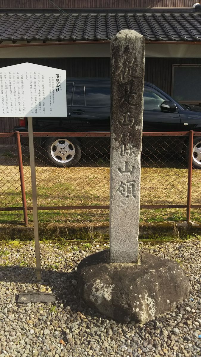
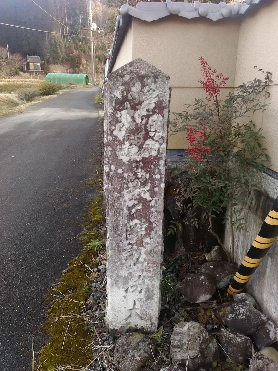
The Fukusumi area was once divided into the Sasayama Domain (now Sasayama City) and the Kameyama Domain (now Kameoka City), and it is said that the present Kawara and Hadakasu areas were on their border. "From Here, It is the West Sasayama Domain" is written on this stone pillar, and it is thought that it was a stone pillar that showed the border. This stone pillar was made in the Edo period and was stored in an individual's house. It was moved to its present location, which was stated to be the original location of the Domain border, in the 26th year of the Heisei period (2014). Location:Hadakasu
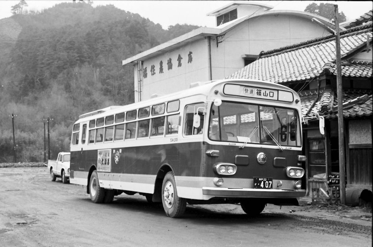
The Old Japanese National Railways Fukusumi Station was the final station of the Japanese National Railways Sasayama Line that operated from the 19th year of the Showa period (1944) to the 47th year of the Showa period (1972). In the dawn of the railways, the Sasayama line was planned to connect from what is now Sonobe Station (the present Sonobecho of Nantan City in Kyoto) to Sasayama, and activities to invite and attract people were developed in the surrounding regions including Fukusumi. Then, during the war in the 19th year of the Showa period (1944), the Sasayama line that connected from what is now JR Sasayamaguchi to Fukusmi was opened as a national policy line in order to carry resources used in the war such as manganese mined out of Honmyodani in Fukusumi. Even after the war, it was used to commute to work and school, but through the policy of organizing unremunerative local lines of the old Japanese National Railways, the line was discontinued in the 47th year of the Showa period (1972). Location:Fukusumi The state of the Sasayama line on the day it was discontinued:https://videotube.sasayama.jp/dtl.php?VID=34 (Link: Sasayama City Audio-Visual Library)
Honjin Ruins
![]() Historic
Historic

A Honjin was a place where daimyo lodged in when they did Sankin-kotai (a policy where daimyo had to alternate living in their Domain and in Edo for a year) in the Edo period, and the house of Rokuzaemon Ogita, which was used as a Honjin, used to be here. At present, the old Fukusumi Elementary School stands there, and there is a stone marker in that site showing that this place used to be a Honjin. Location:Fukusumi 342
Waki-Honjin Ruins
![]() Historic
Historic
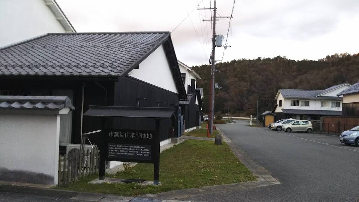
A Waki-Honjin was used when lodging places were not enough with just a Honjin (a place where daimyo lodged in when doing Sankin-kotai, the policy where daimyo had to alternate living in their Domain and in Edo for a year). Here, there used to be the house of Kaemon Yamada, which was used as a Waki-Honjin. There were also times when the Yamada house was used as a Honjin, and it is said that it was used as a Honjin in the 11th year of the Bunka era by Tadataka Ino, who visited Fukusumi on a journey of surveying the area, and in the fourth year of the Keicho era (1868) by Kinmochi Saionji, who went to battle as a chinbushi official of San'in. At present, the Municipal Fukusumi Honjin Complex stands there. Location:Fukusumi 388-2
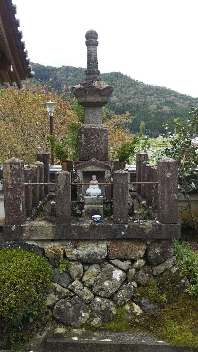
In the middle of the Edo period, a village headman known as Hanzaemon Shirai carried out a plan to dig small ditches for fireproofing and irrigation during fires. However, he was blamed for carrying out a plan without permission in the Domain, and was given the death sentence. After that, fires frequently occurred in Fukusumi, and people one after another stated that they saw the figure of Hanzaemon riding a white horse during those fires. And so, a memorial tower to comfort Hanzaemon's ghost was built. Every year on November 28th, a memorial service is held in front of the memorial tower. Location:Fukusumi 274
Niki Castle
![]() Historic
Historic
Niki Castle is a mountain castle built on Katsurayama Mountain of Fukusumi, which is a town that was an important position of traffic, being the merging point of Saikyo Road and Nose Road in the Muromachi period. The lord of the castle, the Niki Clan, was a family of the Ashikaga Clan, the Shogun family of the Muromachi Shogunate, and it is thought that they ruled the eastern part of Taki County. At present, almost no relics of the castle remain, and only a small area name known as, "Ninnyudo" is left. It is said that the main temple gate of Nyorai-ji Temple at the base of the mountain is made from removing and rebuilding the castle gate and foundation stones of Niki Castle. Location:Fukusumi
 Scenic
Suminoe no Niwa
![]() Scenic
Scenic
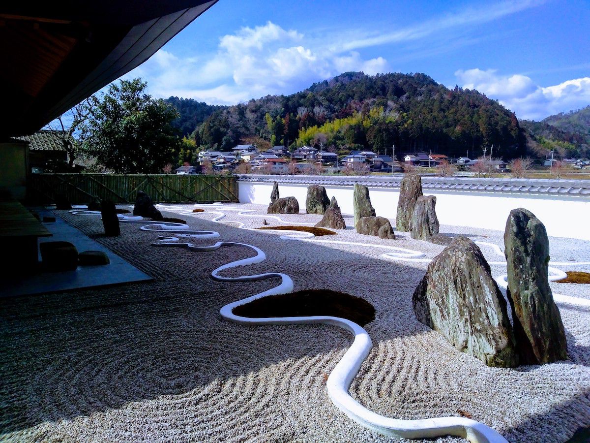
Suminoe no Niwa is a garden created in the 41st year of the Showa period (1966) by a famous landscape gardener who represented Japan, Mirei Shigemori. This garden was created with the theme of the scenery of waves and the seascape of Sumiyoshi, as the Sumiyoshi Shrine was for a sea deity. The distinctive arrangement of stones expresses Horaijima (a place where a wizard was said to live in ancient China), and the three undulations going across the garden express waves. The bamboo fence is called an "aboshi fence" and abstractly designs the scene of fishermen hanging nets to dry on the seaside as a bamboo fence. Shigemori created many gardens, but he said that he highly evaluated this garden as one that even he himself could agree with, and it can be said to be one of the best famous gardens in terms of modern dry landscape gardens. Location:Kawara 270