Map of San Diego - 1876
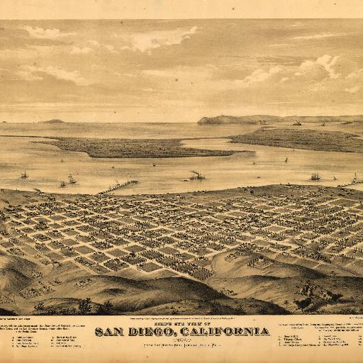
Perspective map not drawn to scale. Includes text and index to points of interest. LC Panoramic maps (2nd ed.), 33 Available also through the Library of Congress Web site as a raster image. AACR2: 651/1; 710/1
The maps in the Map Collections materials were either published prior to 1922, produced by the United States government, or both (see catalogue records that accompany each map for information regarding date of publication and source). The Library of Congress is providing access to these materials for educational and research purposes and is not aware of any U.S. copyright protection (see Title 17 of the United States Code) or any other restrictions in the Map Collection materials.
Posted by:
Gio from Stroly
update date: 2018.10.29
このマップ(地図)を見る