Map of Salem Village in 1692
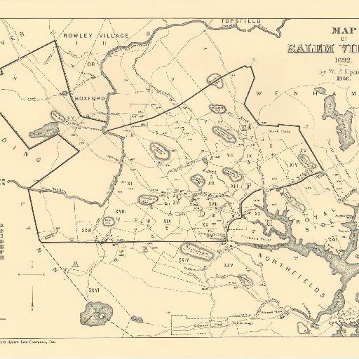
Map of Salem Village in 1692 By W.P. Upham, 1866 From Charles W. Upham's Salem Witchcraft, With an Account of Salem Village and a History of Opinions on Witchcraft and Kindred Spirits (1867). This map shows the locations of major landmarks, farms, land grants, physical features, and the dwellings of prominent and important residents in Salem during 1692. W.P. Upham, brother to author Charles, researched and drew the map. In his notes to the volume, Charles Upham included some details about how land grants were located and drawn, but is largely silent about how his brother located the dwellings of the major actors in the Salem narrative: The map, based upon various local maps and the Coast-Survey chart, is the result of much personal exploration and perambulation on the ground. It may claim to be a very exact representation of many of the original grants and farms. The locality of these houses, mills, and bridges, in 1692, is given in some cases precisely, and in all with near approximation. The locations of then-existing roads have been obtained from the returns of laying-out committees, and other evidence in the records and files. The construction of the map, in all its details, is the result of the researches and labors of W. P. Upham.
All spots information
0 spots