Map of the Atlantic Charter (French), 1943
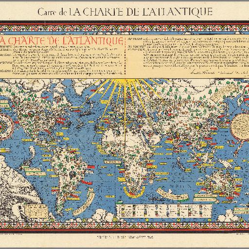
Color pictorial map of the world, on sheet 87.5x114. Stereographic projection. Includes legend, text boxes on historical events, and note at the head of the map "La charte de l'Atlantique" with the signatures of Franklin Roosevelt and Winston Churchill, The Atlantic Charter was a pivotal policy statement issued in August 14, 1941 that, early in World War II, defined the Allied goals for the post-war world. It was drafted by the leaders of Britain and the United States, and later agreed to by all the Allies. Map shows political boundaries, major cities, vignettes representing various agricultural products, industry and mineral resources. Includes compass rose, distances, naval and air bases. This French edition is rare.
All spots information
0 spots