London, 1851
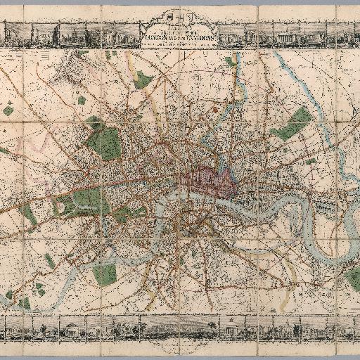
Detailed full color pocket decorative map of London, one of the most decorative of all of Tallis' City Plans, on sheet 56x75. Dissected into 18 section, backed with linen, folded into red covers 19x13, with title "Tallis's illustrated plan of London, 1851" embossed in gilt with gilt decorations, on front and blind stamped on back cover, same stamp as front. Map borders with 48 city views, extending to Hammersmith in the west, clockwise to Cricklewood, Hampstead, Stamford Hill, Leytonstone, Greenwich, Peckham, Battersea Rise and Parson's Green. Shows color coded boundaries of boroughs, roads, streets, city blocks, buildings, landmarks, parks and places of interest. Relief shown by hachures. Includes legend.
All spots information
0 spots