Paris (1784)
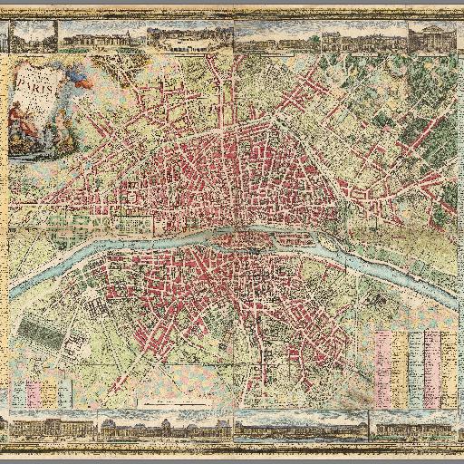
Digital composite of sheets 1-4. New road map of Paris and suburbs 98.5x142, on 4 sheets 54x78. Main buildings illustrated by M. Pichon, map engraved by Michel Glot. Published by Esnauts and Rapilly. Centered on the Seine, depicts Paris prior to the French Revolution. Covers Paris on both sides of the Seine. Framed by a floral border. Title cartouche showing angels and an allegory of Paris with the symbols of the arts and sciences. Around the map are 28 views of places and landmarks. The map shows streets, parishes, colleges, hospitals, important buildings, landmarks, major squares and other points of interest. Includes tables identifying points of interest. The present example is an early state of the plan. There is an earlier edition of 1783 and later editions of 1789, 1792, 1794, 1801 and 1802. The later editions apparently have significant revisions, especially those issued after 1793.
All spots information
16 spots