カリフォルニア州 (1909)
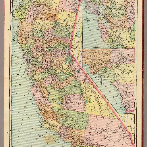
Map in full color. Relief shown by hachures. Shows counties, settlements, railroads, etc. Includes Inset maps of the San Francisco Bay and Sacramento-San Joaquin Delta region and of a part of Southern California.
すべてのスポット情報
0件のスポット
Map in full color. Relief shown by hachures. Shows counties, settlements, railroads, etc. Includes Inset maps of the San Francisco Bay and Sacramento-San Joaquin Delta region and of a part of Southern California.
0件のスポット