バークレー (1880)
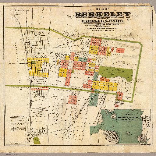
現在「全米で政治的・社会的に最も進歩的な都市として知られている」(WikiPedia:バークレー(カリフォルニア州)より)バークレーの19世紀の地図です。<br> <br>Hand col. Relief shown by hachures. Shows drainage, tracts, land ownership, railroads, etc. Includes regional map. Oriented with north toward upper right.
すべてのスポット情報
0件のスポット