Japan (1897)
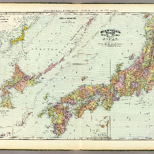
<html> <body>Col. map in 2 segments. Relief shown by hachures and spot heights. Insets: Outline map of Japan. Scale (ca. 1:22,000,000) -- Ryukyu Islands. Scale (ca. 1:5,300,000) -- (Taka and Matsu islands -- South Extension of Osumi Province. Title in margin: Rand, McNally & Company's indexed atlas of the world. </body> </html>
All spots information
0 spots