ロンドン (1915)
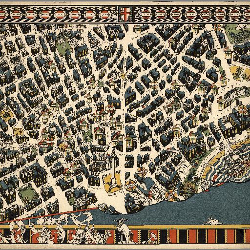
<html> <body> 一般にロンドンの中心と見なされることも多い交差点、チャリング・クロスとその周辺の地図です。交差点の北にはトラファルガー広場があり、古くから道路標識や地図にはチャリング・クロスからの距離が表示されていたことでも知られます。 (<a href="http://ja.wikipedia.org/wiki/%%E3%%83%%81%%E3%%83%%A3%%E3%%83%%AA%%E3%%83%%B3%%E3%%82%%B0%%E3%%83%%BB%%E3%%82%%AF%%E3%%83%%AD%%E3%%82%%B9">WikiPedia:チャリング・クロス</a>より) Colorful pictorial map of the London Theater district, commissioned by the Underground Electric Railways Company in 1915, printed and published by the Westminster Press, whose owner and Managing Director was Gerard T Meynell. Border with name of all the theaters in the district. Showing the principal streets and buildings, the theaters, the parks, and the Underground Stations. It is filled with detail of a humorous character, the peculiarities of every district being happily parodied, and it forms an abundant source of amusement. </body> </html>
すべてのスポット情報
0件のスポット