Roma (1882)
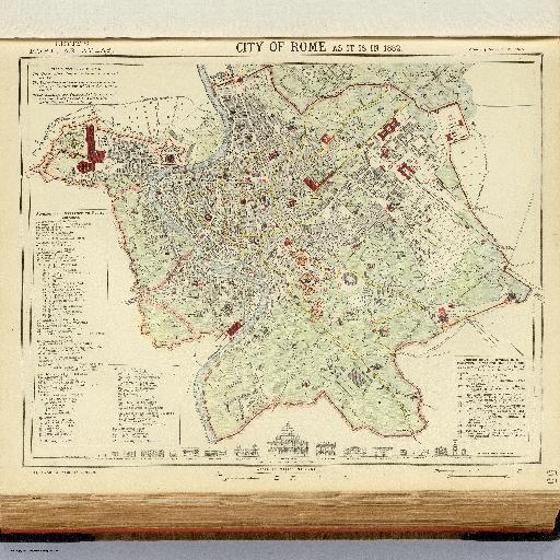
<html> <body>Colored map. Shows buildings (with key), cultivated ground and gardens, rioni or districts, etc. Includes drawings of building facades: A comparison of the principal modern buildings in Rome. The drawings are identical to those on W.B. Clarke's Plan of modern Rome, 1830, in: Maps of the Society for the Diffusion of Useful Knowledge, 1844 (our list no. 0890.202) </body> </html>
All spots information
0 spots