アメリカ開拓時代 (1886)
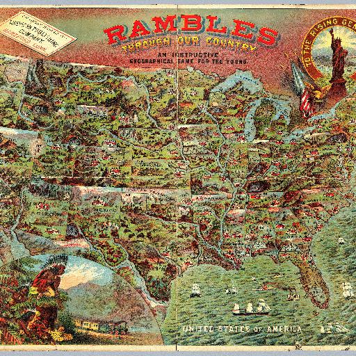
<html> <body>州単位で区切られたカラフルな地図で、主要都市に番号が振ってあります。列車の走る脇に先住民族の姿も(1869年にはアメリカ大陸横断鉄道が開通しています)。アメリカの開拓時代を彷彿とさせる絵地図です。<br>This is meant to accompany a board game with a map of the United States (see our #5086). However, it functions as a geography of the U.S. by itself. In full color. </body> </html>
すべてのスポット情報
0件のスポット