キューバ (1853)
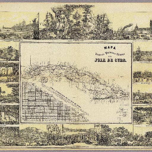
<html> <body>Lithographic color map with an inset table of distances from principle cities with their longitude and latitude noted. Views of cities, ports, and events such as cock fighting and the aftereffects of an 1846 hurricane surround the map. Date estimated. マップの周りに描写されている挿絵を見ていても面白い。庶民・華族の生活形態や、周りが海で囲まれている為、船や海の時化の状態をきれいに描かれている。 </body> </html>