Route of the American Airlines (1945)
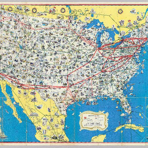
<html> <body>Relief shown by hachures and spot heights. Pictorial map showing routes of American and other, connecting airlines, points of interest, etc. Includes connections to Mexico, Cuba, the Bahamas and southern Canada. Folded into self covers 21 x 10 titled "American Airlines system map. Route of the flagships." </body> </html>
すべてのスポット情報
0件のスポット