Map of the whole Lake Biwa area
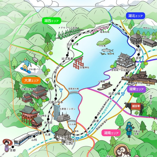
Produced by the Biwako Branch of the JTB Ryokan Hotel Federation! With the digital walking map using Stroly, you can now easily check out attractive spots in Shiga and Omi. You can easily look up information on sightseeing spots, attractions, restaurants and accommodation facilities in Shiga online via smartphone or PC, so you can smoothly visit sightseeing spots that are accessible from your current location or places you have been curious about. Move to the map from the Kohoku, Kosei, Koto, Konan and Otsu area pins, centred on Lake Biwa, the largest lake in Japan, You can see information on spots in each of these unique areas. 👇Click here 👇 for Instagram with great information on Shiga Prefecture. https://www.instagram.com/jtbryohoren_biwakoshibu/?igshid=NTc4MTIwNjQ2YQ%3D%3D
 Posted byJTB滋賀支店 デジタルマップ事業Updated:
 All spots information
6 spots
 湖北エリア
湖北エリア
 使い方
使い方

おすすめコース おすすめコースタイトル --> マップの使い方 地図上のピンをクリックすると、各エリアのマップへリンクすることができます。 また、観光におすすめのコースもご紹介しております。 ボタンの機能について スポット一覧リストが開きます。カテゴリーごとに表示・非表示を変更可能です。 Googleマップとの切替が可能です。衛星写真など他のマップに切り替えることもできます。再度押すと表示が戻ります。 友人同士、家族同士など限られた方限定のURL(ルーム機能)を作成できます。 マップのタイトル・説明文など、マップに関する各種情報をご確認いただけます。 GPS機能について マップ上にあなたの現在地が表示されます。(マップの範囲内にいる場合) 現在地共有を行うかについて、確認用のダイアログが表示されます。「共有する」をクリックしてください。 --> 現在地共有が行われている間、アイコン表示が変化します。 --> 滋賀県内の素敵な情報を発信中!! 👇Instagramはこちら👇 👆バナーをクリック👆
 大津エリア
大津エリア

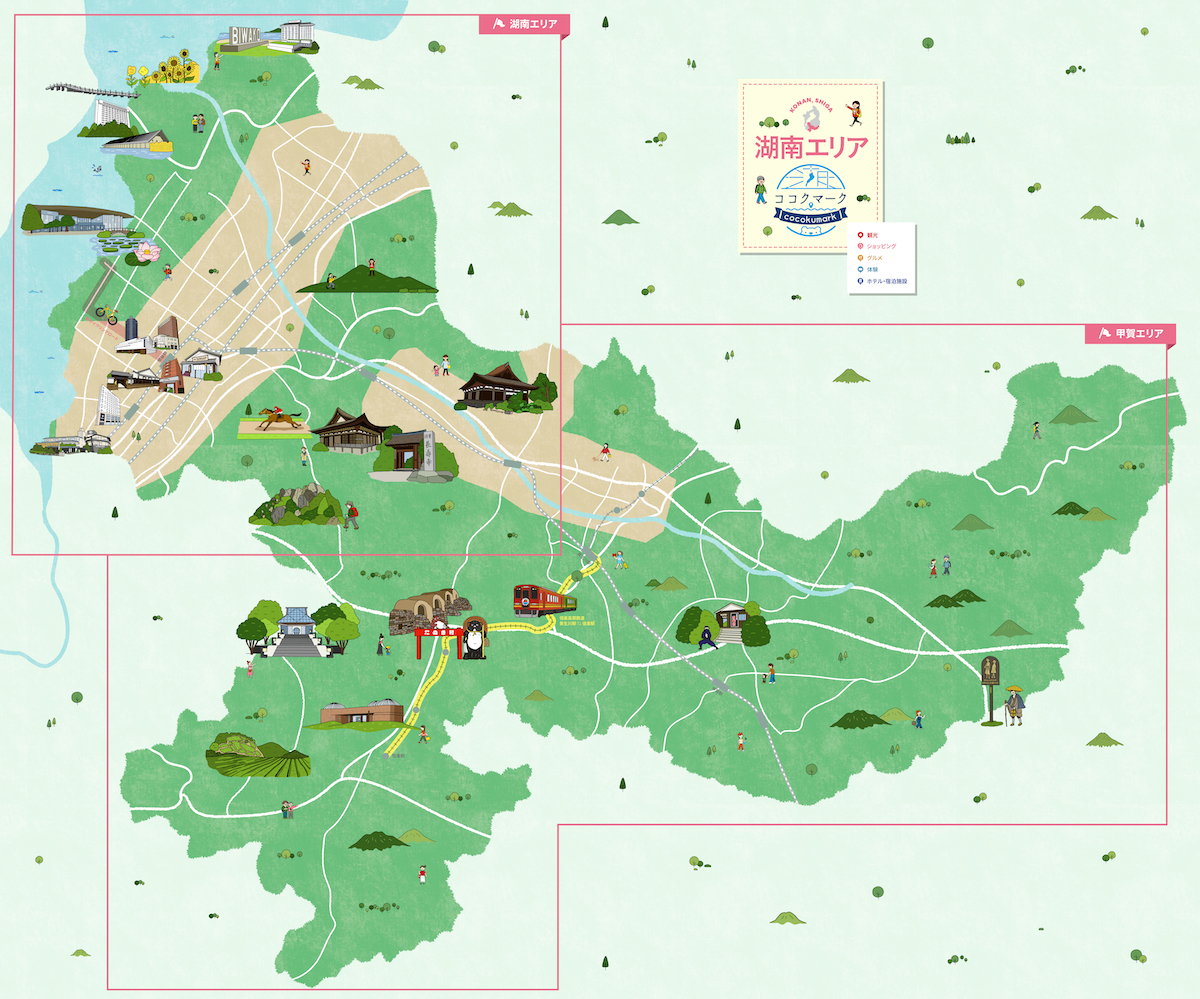
 湖南エリア
湖南エリア
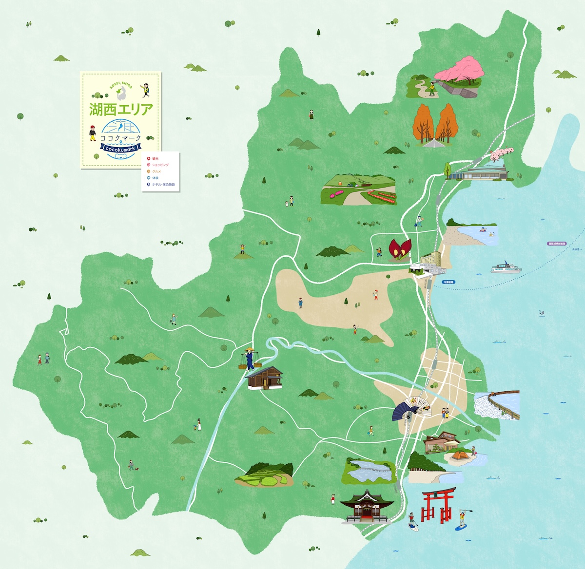
 湖西マップ
湖西マップ
 湖東エリア
湖東エリア

👇マップをタップして大きいマップでみる👇 湖東エリアマップでは「湖東エリア」「東近江エリア」「彦根城下町エリア」のおすすめ情報を掲載しております。 ☆歴史と文化の湖都★厳選スポット☆ 豊郷小学校旧校舎群 彦根城 八幡堀 ブルーメの丘 水郷めぐり(北之庄町) スポット情報の他に、モデルコースもご紹介しております。 👇モデルコースをチェック👇 世界遺産登録までもう少し!注目の国宝「彦根城」入門&城下町を巡る半日プラン 👇モデルコースをチェック👇 滋賀県【湖東エリア】で女子旅!穴場スポット2泊3日満喫コース 滋賀県内の素敵な情報を発信中!! 👇Instagramはこちら👇 👆バナーをクリック👆