Mapa de los Estados Unidos Mexicanos - 1938
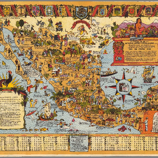
Humorous color pictorial map of Mexico. Shows settlements, landmarks, people with local customs, animals, recreational activities, plants and fruits, etc. Includes a decorative compass rose at lower right. Bordered by vignette illustrations of coat of arms at three panels and 1938 calendar on the lower panel. Includes numerous notations on the map, decorative cartouches and text insets.
All spots information
0 spots