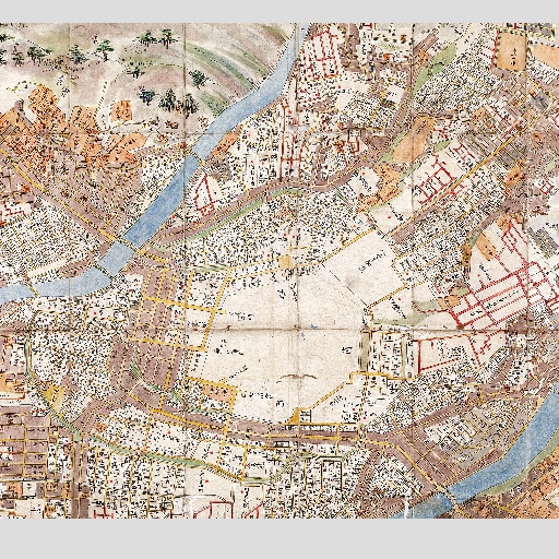
05_Kanazawa Old Map (1857)
まち歩きが楽しくなる金沢スマホマップ。金沢観光や散策に欠かせない観光マップはもちろん、江戸時代末期の古地図、地元ホテルマンがお薦めするジョギング・ウオーキングマップが、自分の位置と連動しながら金沢の魅力を紹介。 Check out these maps from Kanazawa, aimed to make your trip more fun by using your smartphone! Not only will you find sightseeing spots and recommended walking/jogging routes, but you can travel back to the Edo period and explore the changes. Don't worry about getting lost, as you will be able to see your GPS location at all time while enjoying the local charm of Kanazawa.
 Posted byJTB-mapperUpdated:
 All spots information
55 spots
 2.Ruins
West Inner Moat
![]() 2.Ruins
2.Ruins
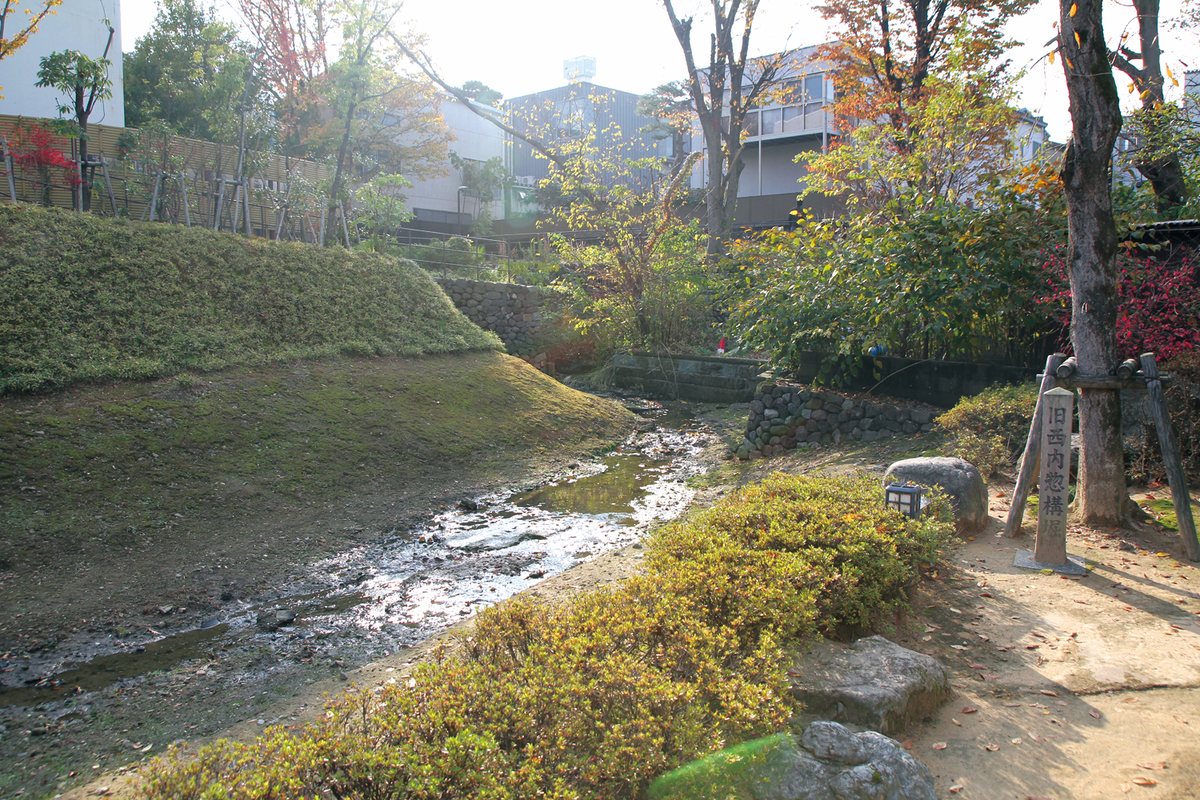
This was constructed by the famous “Christian General” Takayama Ukon when the Maedas were suspected by Tokugawa Ieyasu of plotting against him in 1599, to serve as a western inner line of defense for the castle. The fortifications used a moat and earth embankment system, and stretched some 1.6 km from Oyama Shrine to the Asanogawa River via Owari-cho. A short section that looks as it would have originally can be seen in the Ryokusuien park by Kazue-machi, near the Asanogawa River end.
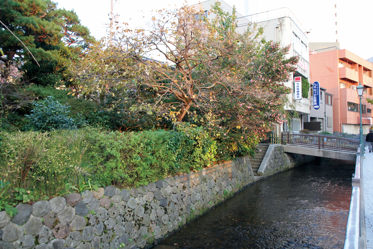
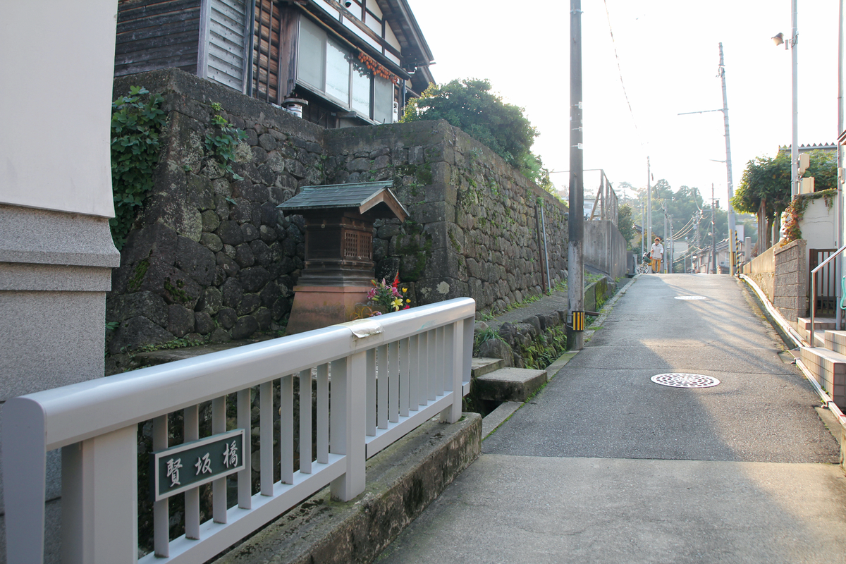
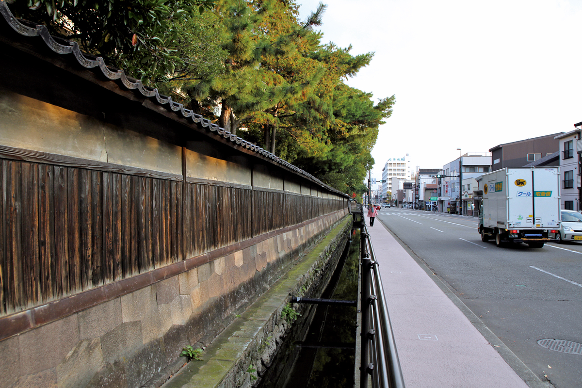
This was constructed by the famous “Christian General” Takayama Ukon when the Maedas were suspected by Tokugawa Ieyasu of plotting against him in 1599, to serve as a western outer line of defense for the castle. The nearly 3 km long moat runs from Honda-machi 3-chome to Nagamachi, where it is known as the Kuratsuki Waterway, and ends in the Asanogawa River. The embankments on the inner side were planted with bamboo and other vegetation, forming a green belt.
This was constructed by the famous “Christian General” Takayama Ukon when the Maedas were suspected by Tokugawa Ieyasu of plotting against him in 1599, to serve as a western outer line of defense for the castle. The nearly 3 km long moat runs from Honda-machi 3-chome to Nagamachi, where it is known as the Kuratsuki Waterway, and ends in the Asanogawa River. The embankments on the inner side were planted with bamboo and other vegetation, forming a green belt.

This was constructed by the famous “Christian General” Takayama Ukon when the Maedas were suspected by Tokugawa Ieyasu of plotting against him in 1599, to serve as a western outer line of defense for the castle. The nearly 3 km long moat runs from Honda-machi 3-chome to Nagamachi, where it is known as the Kuratsuki Waterway, and ends in the Asanogawa River. The embankments on the inner side were planted with bamboo and other vegetation, forming a green belt.
This was constructed by the famous “Christian General” Takayama Ukon when the Maedas were suspected by Tokugawa Ieyasu of plotting against him in 1599, to serve as a western outer line of defense for the castle. The nearly 3 km long moat runs from Honda-machi 3-chome to Nagamachi, where it is known as the Kuratsuki Waterway, and ends in the Asanogawa River. The embankments on the inner side were planted with bamboo and other vegetation, forming a green belt.
This was constructed by the famous “Christian General” Takayama Ukon when the Maedas were suspected by Tokugawa Ieyasu of plotting against him in 1599, to serve as a western outer line of defense for the castle. The nearly 3 km long moat runs from Honda-machi 3-chome to Nagamachi, where it is known as the Kuratsuki Waterway, and ends in the Asanogawa River. The embankments on the inner side were planted with bamboo and other vegetation, forming a green belt.
East Inner Moat
![]() 2.Ruins
2.Ruins
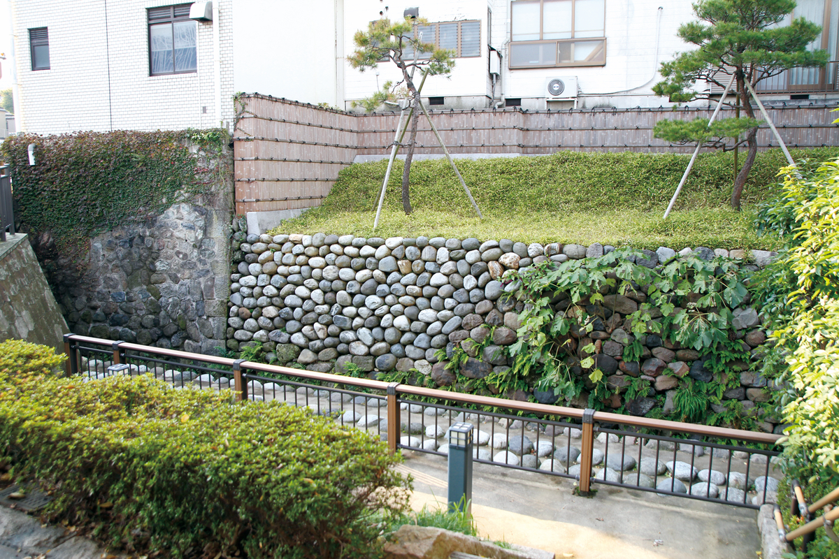
This was constructed by the famous “Christian General” Takayama Ukon when the Maedas were suspected byTokugawa Ieyasu of plotting against him in 1599, to serve as a eastern inner line of defense for the castle. The moat runs for about 1.3 km from Kojiridani-saka to the Asanogawa river through Hashiba-cho. The embankments on the inner side were planted with bamboo and other vegetation, forming a green belt.
East Inner Moat
![]() 2.Ruins
2.Ruins
This was constructed by the famous “Christian General” Takayama Ukon when the Maedas were suspected byTokugawa Ieyasu of plotting against him in 1599, to serve as a eastern inner line of defense for the castle. The moat runs for about 1.3 km from Kojiridani-saka to the Asanogawa river through Hashiba-cho. The embankments on the inner side were planted with bamboo and other vegetation, forming a green belt.
East Outer Moat
![]() 2.Ruins
2.Ruins
This was constructed by the famous “Christian General” Takayama Ukon when the Maedas were suspected byTokugawa Ieyasu of plotting against him in 1599, to serve as a eastern outer line of defense for the castle. The moat runs for about 1.4 km from Hassaka to the Asanogawa river through Zaimoku-cho. The embankments on the inner side were planted with bamboo and other vegetation, forming a green belt.
Kanazawa Medical Center
![]() 2.Ruins
2.Ruins
加賀藩年寄役奥村宗家(加賀八家1万7000石)の屋敷跡地。奥村宗家の祖、奥村永福は尾張国荒子で前田利家の父利春、兄利久に仕え、のち前田利家に仕え、伊予守と名乗った。代々年寄役として藩に仕え、前田家創業時以来の功臣の家柄である。屋敷は初め、金沢城内にあったが、後に、この地に移転し、明治を迎えた。明治以降は陸軍衛戍病院、国立金沢病院を経て現在に至る。
Sekisuke Baba Monument
![]() 2.Ruins
2.Ruins
This area used to be a riding ground (baba). Saga Sekisuke, a low-ranking samurai in charge of horses and tackle, revived what had been an abandoned ground during the rule of the third Lord Maeda in the early 17th century.

寛政4(1792)年に現在の兼六園に建てられた藩校の文学校明倫堂と武学校経武館が、文政5(1822)年3月にこの地に移転し、明治3(1870)年に廃止されるまで、教育の拠点となった。明治19(1886)年、全国5地区に分けて1校ずつ高等中学校を設立する中学校令が公布され、翌年第四高等中学校がこの地に開校、明治27(1894)年第四高等学校(四高)と改称された。

These two houses used to belong to ashigaru, or foot-soldier, families, and have been relocated and restored to close to their original condition. They are now operated by the city as a free museum for visitors to understand something of the lifestyle of the lowest-ranking samurai. Each house is fully detached, and surrounded by a hedge rather than an earth wall, while trees were planted in the grounds. One of the two houses, belonging to the Shimizu family, was lived in by their descendents until 1990, while the other, belonging to the Takanishi family, was lived in right up until 1994. Both houses were located in Hayamichi- machi, now Saiwai-cho/Kikugawa 2-chome, which was where the Kaga Domain’s foot- soldier messengers lived.
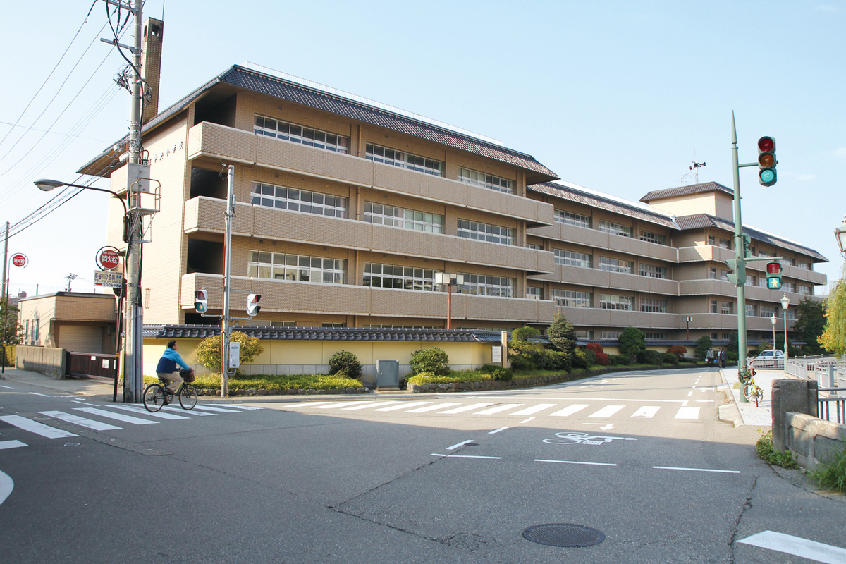
Chuo Elementary School
![]() 2.Ruins
2.Ruins
Site of the Murai Residence With an income of 16,500 koku, the Murai family, one of the “Eight Houses,” the highest-ranking retainers of the Maedas, served as senior political advisors.
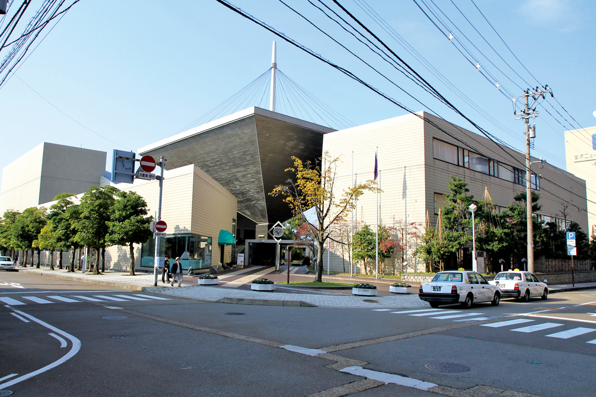
Kanazawa Bunka Hall
![]() 2.Ruins
2.Ruins
Site of the Maeda Chikara/Imaeda Residences These two families, with incomes of 2,400 koku and 14,000 koku respectively, were of “hitomochi” rank, one rank below the senior advisors.
Site of the Cho Residence With an income of 33,000 koku, the Cho family, one of the “Eight Houses,” the highest-ranking retainers of the Maedas, served as senior political advisors.
Rokuto-no-Hiromi
![]() 2.Ruins
2.Ruins

地名は、加賀国住人の林六郎光明の郎党六動太郎光景に由来し、六動林、六斗林にちなむ。広見は桝形や卍形などの広い空間のことで、火災の延焼を防ぐためのまちづくりの一つ。藩主ゆかりの寺社前などにも設けられた。
Kaji-machi
![]() 2.Ruins
2.Ruins
江戸初期、加賀藩はこの地に鍛冶職を集住させ、3代前田利常は御用刀鍛冶には当地に宅地を与え優遇した。元禄8(1695)年の「金沢町絵図名帳」によれば、御普請鍛冶・刀鍛冶・鋳物師細工鍛冶関係の職人が居住している。
鍛冶町の西に並行して、ほぼ南北に延びる両側町。はじめは木ノ新保新町と呼ばれていた。町名は新たに町立てしたことにちなむ。文化8(1811)年の家数は118軒で、うち武家・小者は29軒とあるように、町人の町であった。
Horikawa Ageba
![]() 2.Ruins
2.Ruins
元和6(1620)年宮腰(現・金石)・大野の両湊から船を入れるため堀川を通した。金沢城下への舟運が盛んに行われ、両湊から運ばれた荷物を陸揚げした場所が当地である。
Tamai-machi
![]() 2.Ruins
2.Ruins

明治2(1869)年に成立。もとは加賀藩士玉井勘解由屋敷・同下屋敷地。元禄6(1693)年の侍帳には「安江木町専光寺近所」とあることから、江戸時代初期から居住していたと考えられる。玉井家の初代頼母は慶長5(1600)年前田利長に仕えて知行4千石を受け、足軽頭を勤め元和元(1615)年に没した。子孫も代々藩に仕え、知行5千石を受けていた。
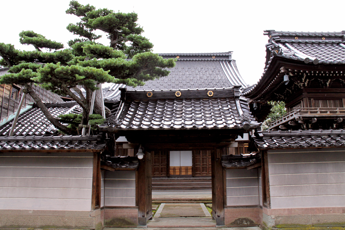
Oyama Jinja Shrine
![]() 2.Ruins
2.Ruins

This shrine was founded in 1873 by former Kaga retainers on the grounds of the old Kanaya Palace of Kanazawa Castle, a separate area across the moat that was used as a retirement villa by former clan lords. The shrine was dedicated to Lord Maeda Toshiie, the first lord of the Kaga Maeda clan, and his wife Matsu, with Toshiie’s spirit deity being transferred from Utasu Hachimangu Shrine. The three-story shrine gate, dating from 1875, has been designated as a national Important Cultural Property.
 1.Extant
Onosho Waterway
![]() 1.Extant
1.Extant
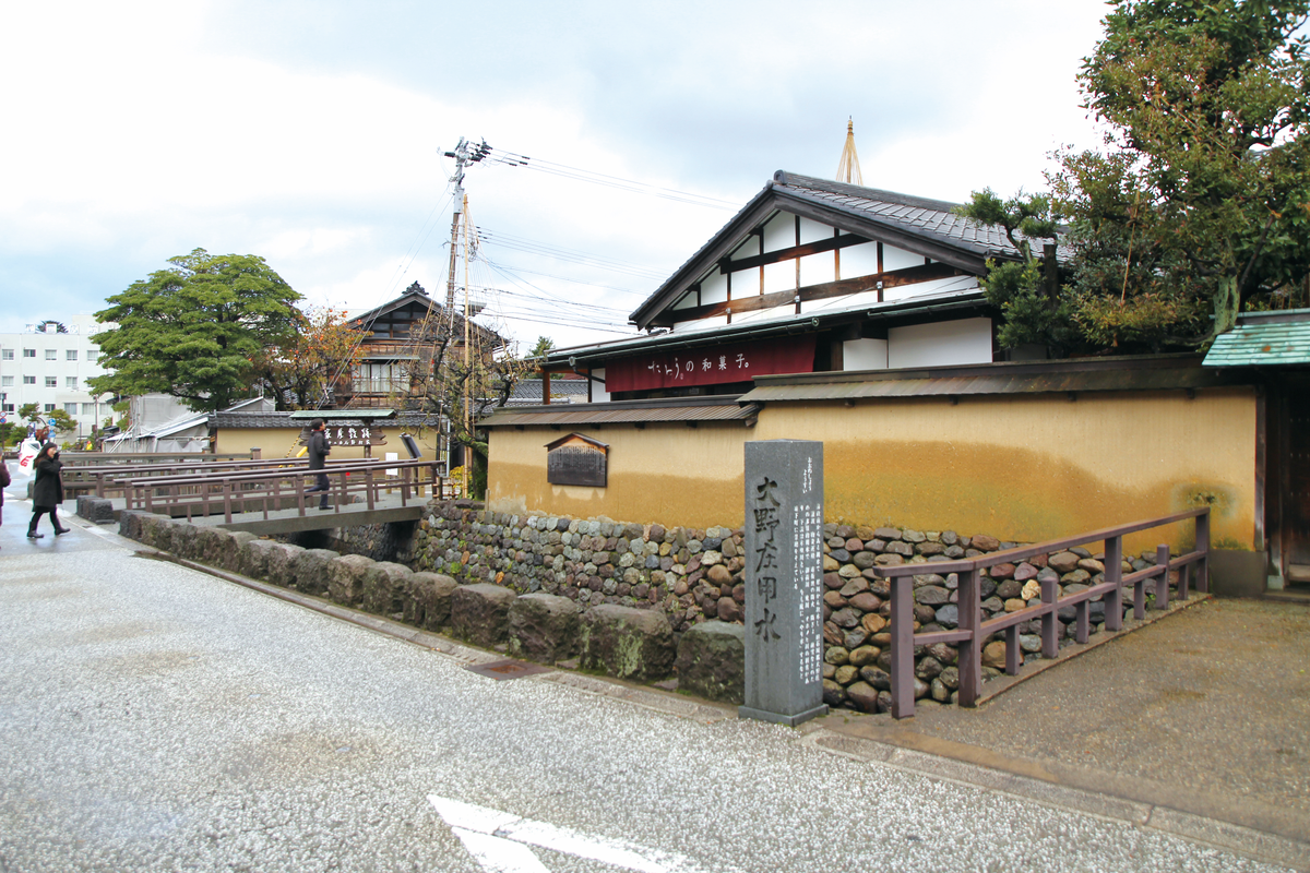
The present sluice gate is on the right bank of the Saigawa river, upstream near Sakurabashi Bridge. Water flows through a culvert under the river bank, and into an open conduit upstream of Shinbashi Bridge. This waterway then flows through the Nagamachi Bukeyashiki area to the mouth of the Saigawa river, covering a distance of about 10 km. This waterway is believed to have been used for carrying timbers to the castle site when Kanazawa Castle was being built.
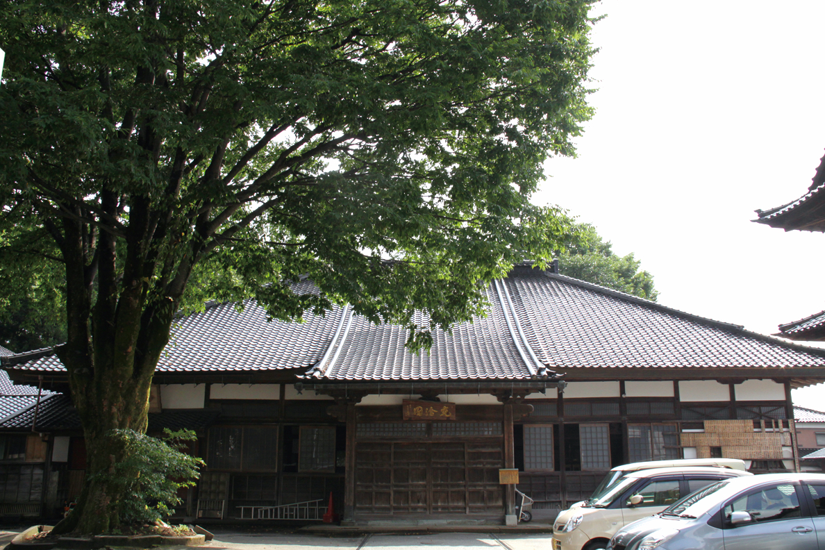
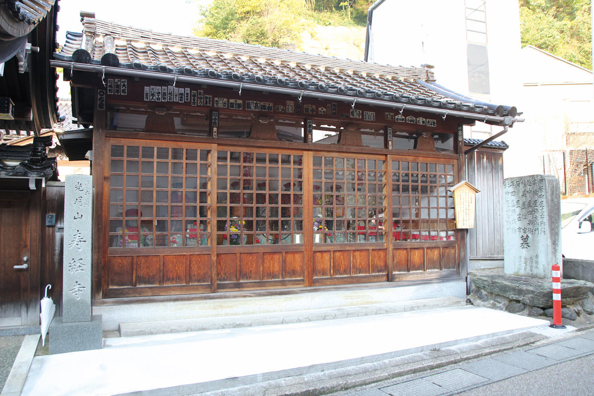
Kyouohji Temple
![]() 1.Extant
1.Extant
日蓮宗の寺院。慶長6(1601)年3代前田利常の生母である寿福院の実家の菩提寺である、越前府中(現・福井県越前市)の経王寺より日護上人を2世として招いて住持とした。寛永8(1631)年江戸で没した寿福院の葬儀が行われたが、その直後の金沢大火で延焼し、正保4(1647)年寿福院の17回忌に利常によって再建された。
Senkoji Temple
![]() 1.Extant
1.Extant
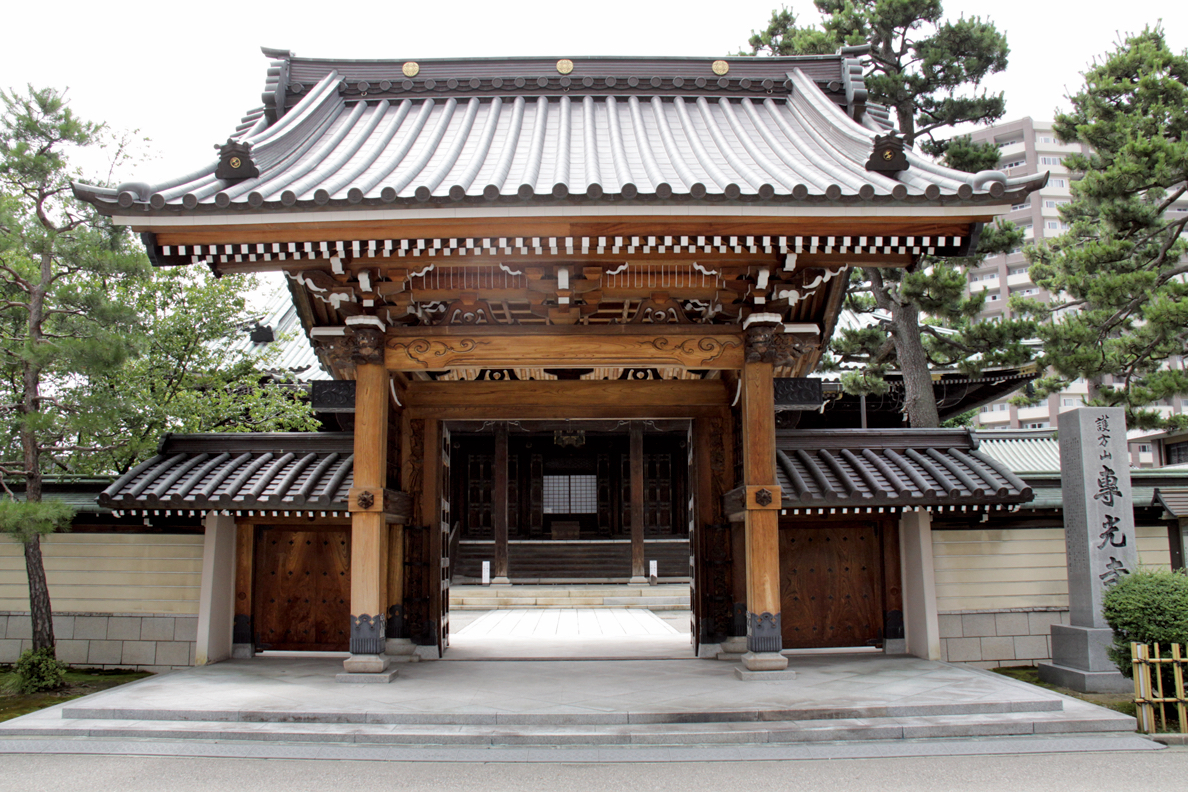
真宗大谷派の寺院で山号は護方山。正和2(1313)年石川郡大糠(現・金沢市大額)に創建し、文明年中同郡吉藤村に移転。天正中同郡鶴来に移り、慶長元(1596)年に御城後町に移転後、元和中現在地に移転した。

初代近岡屋八郎右衛門が、寛政元(1789)年、木ノ新保(現・金沢市本町)に近岡屋として創業。のち現在地に移転し、書籍の出版・販売を商いとした。能楽宝生流の謡本「近八版」は加賀宝生の教本として尊重された。
Meboso-hachirobee Store
![]() 1.Extant
1.Extant

天正3(1575)年創業の針商。成形の難しい絹針の目穴に、初代八郎兵衛は工夫を凝らして今のめぼそ針を作った。糸が通し易いと評価を受け、加賀藩主より「めぼそ」の名前を頂戴した。のちこの針を用いて鮎釣りの毛針を考案し、加賀毛針として世に広まった。
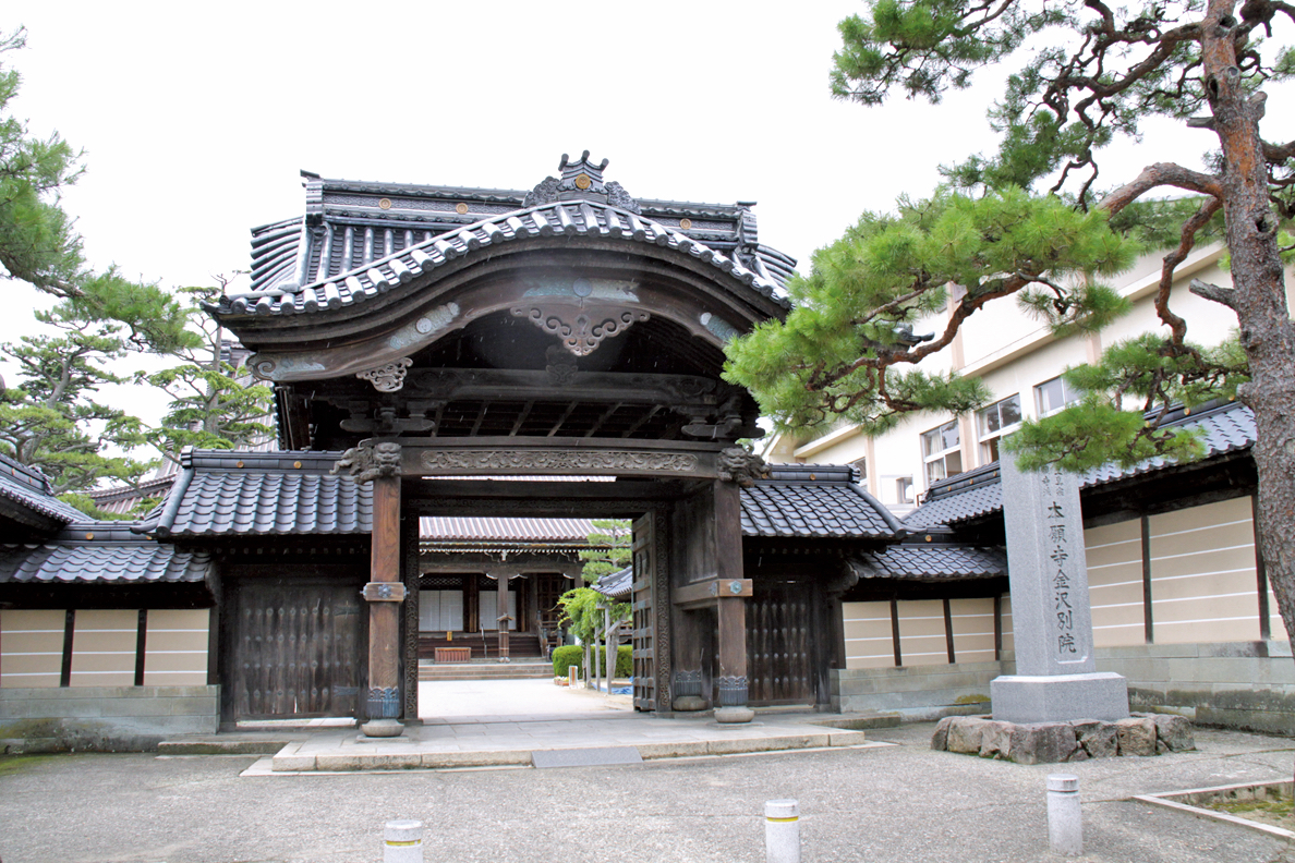
真宗大谷派の金沢別院で東別院と称される。江戸時代は東末寺などと呼ばれた。東末寺は寛永7(1630)年以来、数度焼失し、現在の堂宇は昭和37(1962)年の火災後の再建によるもの。
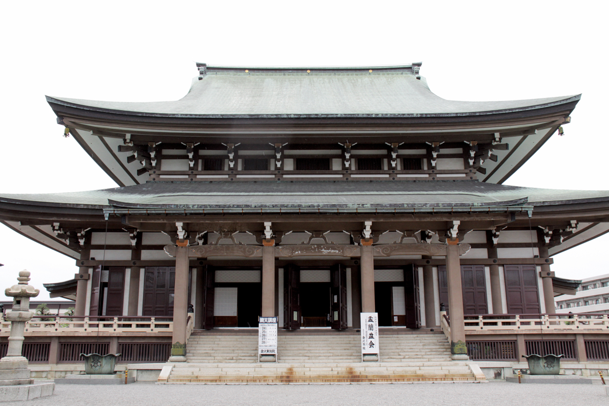
浄土真宗本願寺派の金沢別院で西別院と称される。江戸時代には西門跡末寺・西末寺などと呼ばれた。元和元(1615)年当地に移転した。一方、寛永11(1634)年とする説もある。現在の堂宇は天保8(1837)年の火災後の再建によるもの。

Ryuzoji Temple
![]() 1.Extant
1.Extant
日蓮宗の寺院で山号は妙布山。天正年間の前田利家の時、越前府中から来て河原町に創建したが、のち現在地に移転した。鐘楼は、江戸時代には珍しい2階建ての入母屋造で、本堂とともに金沢市の有形文化財に指定されている。
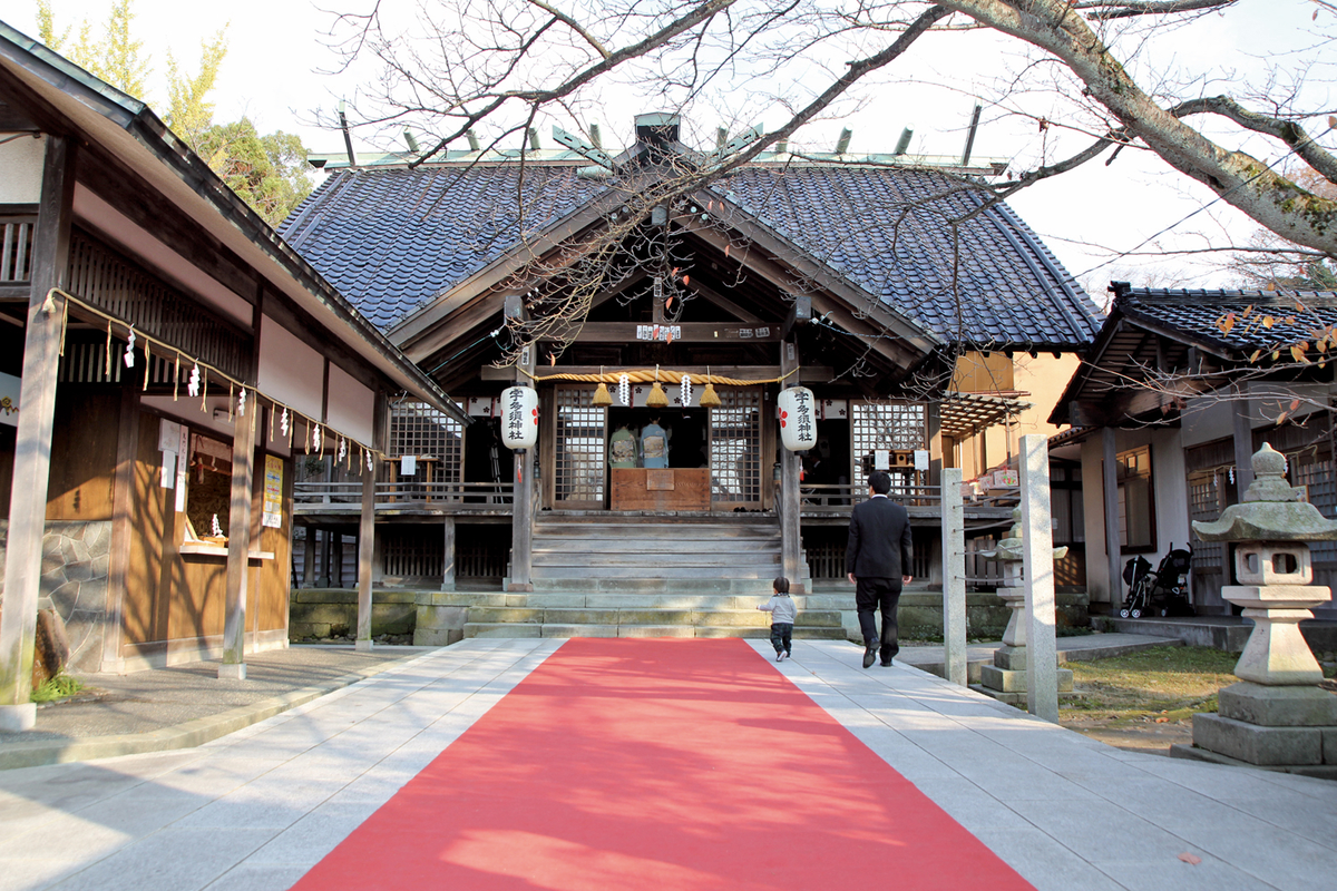
Shinmeigu Shrine
![]() 1.Extant
1.Extant
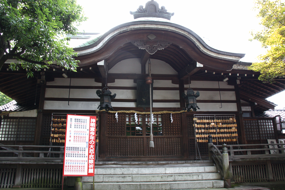
古来より神明宮と称し、始め卯辰の摩利支天山に鎮座したが、延文2年(1357)に今の地に転じ、のちに加賀藩主2代前田利長、3代前田利常から社地が寄進された。毎年5月・10月の15〜17日が春秋例大祭で、悪事災難厄除になるというあぶり餅神事が有名である。境内には樹齢千年を超えるといわれる大欅がある。
Uhoin Temple
![]() 1.Extant
1.Extant

高野山真言宗の寺院で山号は千日山。同寺の縁起によれば、雄勢という僧が諸国行脚の途中伊勢神宮に千日参詣し、満願後の文禄4(1595)年に当地へ来て朽ちた寺を再興した故事によるという。室生犀星はここに預けられ、幼少期を過ごした。
Shogetsuji Temple
![]() 1.Extant
1.Extant
曹洞宗の寺院で山号は瑞亀山。中興の至岸和尚が、加賀藩3代前田利常から小松城内にあった桜を拝領したと伝えられる大桜がある。御殿桜とも呼ばれるこの桜は、国から天然記念物に指定されている。
Fushimi-ji Temple
![]() 1.Extant
1.Extant
高野山真言宗の寺院で山号は行基山。本尊の阿弥陀如来坐像は平安前期の金銅仏で、国から重要文化財に指定されている。また「金沢」の地名となった芋掘藤五郎の伝説から伏見寺と名付けられた。
Saigawa-Ohashi Bridge
![]() 1.Extant
1.Extant
国登録有形文化財。北国街道の犀川大橋として、藩政期から交通の要衝であった。現在の橋は大正13(1924)年に架け替えられた。長さは約62mで、鋼製曲弦ワーレントラス式。平成21(2009)年に青色から青緑系に塗り替えられた。
Hamaguri-zaka
![]() 1.Extant
1.Extant
犀川左岸、大橋橋詰から寺町に抜ける坂道。享保18(1733)年の火災後、町家を後退させ川岸を築いて道を開いたことを、蛤が焼けたあとに口を開く様子にかけたと伝えられる。
Myokeiji Temple
![]() 1.Extant
1.Extant

浄土宗の寺院で山号は安養山。加賀藩士松平康定の菩提寺。康定が3代前田利常から寺地を得て、母妙慶尼の菩提所とした。蛤坂上にあるが、蛤坂が拡張されるまではこの坂を妙慶寺坂といった。
Kannon-in Temple
![]() 1.Extant
1.Extant
Originally located near what is now Kenrokuen, this temple was moved to Mt. Utatsu in 1601, and then to its current location in 1616 at the wish of Princess Tama, the wife of the third Maeda lord. Ever since, generations of daughters of the Maeda family would visit to pray for safe childbirth. Special sacred Noh plays were also performed here under the patronage of the Maedas. The “46,000 Days” event, when a pilgrimage to the temple is considered to grant the good fortune of 46,000 days’ worth of visits, has been held here annually since the Edo period. If you hang corn bought at the temple that day under your eaves, it will keep your family safe and bring prosperity to your business.
Nana-Ine Jizo
![]() 1.Extant
1.Extant
Seven memorial Jizo statues stand at the front gate of the Jukyoji Temple. Three months of cold rains in summer 1858 had devastated the rice crop, causing mass starvation and skyrocketing rice prices. Late at night on July 11th, some 2,000 commoners climbed Mt.Utatsu, from where they could look down over the castle – a forbidden act. There they shouted out “Give us rice!” towards the lord in his castle. As punishment for defying the law, the seven ringleaders were killed, but the domain opened its granaries to feed the people, and these Jizo statues were erected to pray for the repose of those executed men. Even today, they are still offered the rice they were denied in life.
Hosenji Temple
![]() 1.Extant
1.Extant
This temple enshrines Marici, the guardian Buddha of swordsmanship, as its principal icon. Lord Maeda was said to go off to war with an emblem of Marici hidden in his battle helmet. The “Five Pines” here featured in a famous novel written by Izumi Kyoka, and the grounds offer a panoramic view of the city.
Maeda Toshiie’s son Toshinaga founded this shrine in 1599 to venerate his father, but as it was not possible under the Tokugawa Shogunate’s laws to publicly deify him, the deities from the Mononobe Hachimangu Shrine in what is now Takaoka City (Toyama) and the Sakakibara Jinmeigu Shrine in what is now Himi City (Toyama) were transferred here, and the shrine was established to protect the “demons’ gate” direction of the castle. In 1873, after the Tokugawa were overthrown, the spirit of Toshiie was relocated to the new Oyama Jinja Shrine, but the shrine still enjoyed the patronage of locals. Its name was thus changed to Utasu Shrine, reflecting the old name for the hill behind it. In 2004, Toshiie’s spirit was once again enshrined here after a ceremonial division of his spirit from Oyama Jinja Shrine.
Kenroku-en
![]() 1.Extant
1.Extant

5代前田綱紀が延宝4(1676)年に金沢城の外庭として蓮池庭を作ることに始まる。その後、12代斉広が文政5(1822)年、隠居所として竹沢御殿を築造した際、奥州白河藩主の松平定信に「兼六園」の揮毫を依頼した。13代斉泰は斉広の死後、竹沢御殿を取り壊し、霞ヶ池を掘り、栄螺山を造るなどして、庭を拡張・整備し、ほぼ現在の回遊林泉式庭園の形となった。
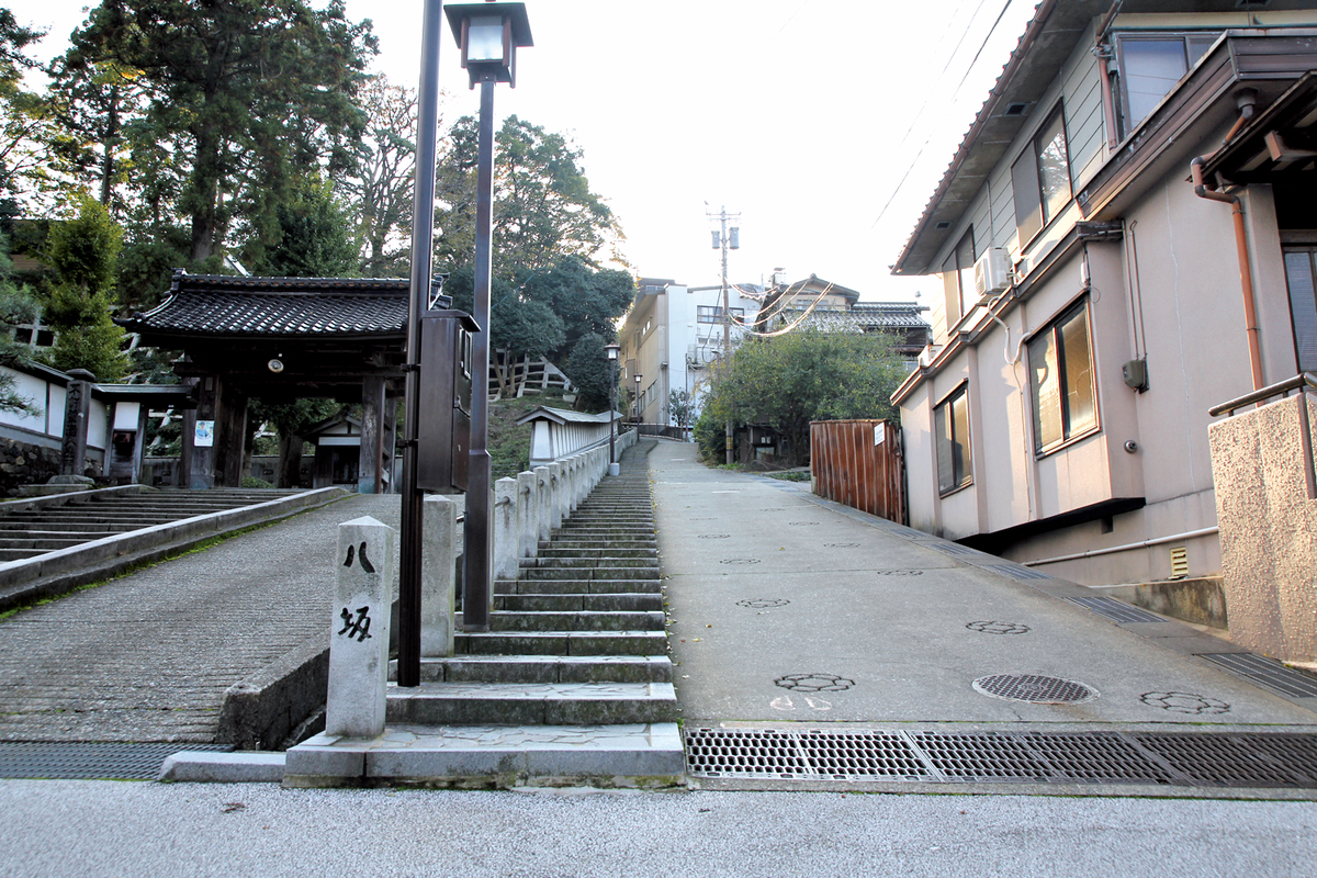
昔、付近の木こりが小立野に通う坂が八つあったことから、またはたくさんあったことから、八坂という名がついた。宝幢寺があったことから宝幢寺坂とも呼ばれた。また、八家奥村家初代伊予守屋敷の横の坂であることから、伊予殿坂とも呼ばれた。
Gokokuzan Hoenji Temple
![]() 1.Extant
1.Extant

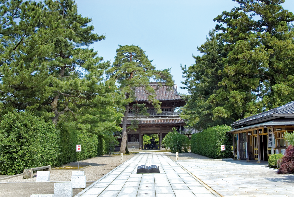
曹洞宗の寺院。天正11(1583)年加賀藩祖前田利家が創建した、前田家の菩提寺。越前府中(現・福井県越前市)に利家が入部したとき大透圭徐和尚に帰依して、同9(1581)年能登に入国後、和尚を迎え七尾宝円寺(現・長齢寺)を開山、のち金沢に移った際本寺を開山した。利家と徳川家康が伏見で会見した際、死を覚悟して自画像と髪を埋めた場所と伝えられる御影堂と御髪堂がある。
Tentokuin Temple
![]() 1.Extant
1.Extant
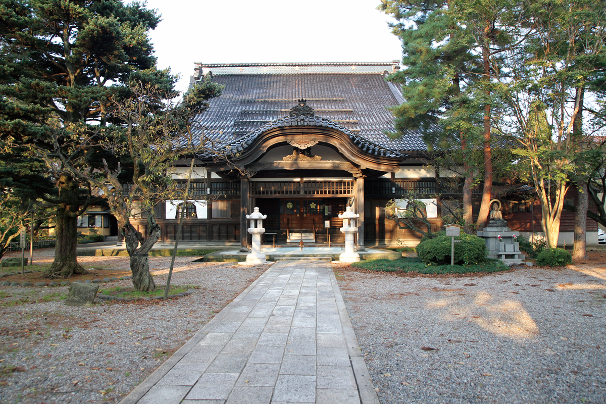
曹洞宗の寺院。3代前田利常夫人の珠姫(2代将軍徳川秀忠の娘)の菩提寺として、元和9(1623)年に建立され、夫人の法号から天徳院と名付けられた。現在の境内地はかなり縮小されているが、山門(県指定有形文化財)などの風格には当時の様子がしのばれる。
Nyoraiji Temple
![]() 1.Extant
1.Extant
浄土宗の寺院。天正年間(1573~92)に越中増山(現・富山県砺波市)に創建され、のち越中高岡を経て金沢の卯辰山麓に移り、寛文2(1662)年現在地に移転した。徳川家康をはじめ、秀忠・家宣・家継・家重などの徳川家の位牌が安置されている。
Onosho Waterway
![]() 1.Extant
1.Extant
The present sluice gate is on the right bank of the Saigawa river, upstream near Sakurabashi Bridge. Water flows through a culvert under the river bank, and into an open conduit upstream of Shinbashi Bridge. This waterway then flows through the Nagamachi Bukeyashiki area to the mouth of the Saigawa river, covering a distance of about 10 km. This waterway is believed to have been used for carrying timbers to the castle site when Kanazawa Castle was being built.
Tatsumi Waterway
![]() 1.Extant
1.Extant
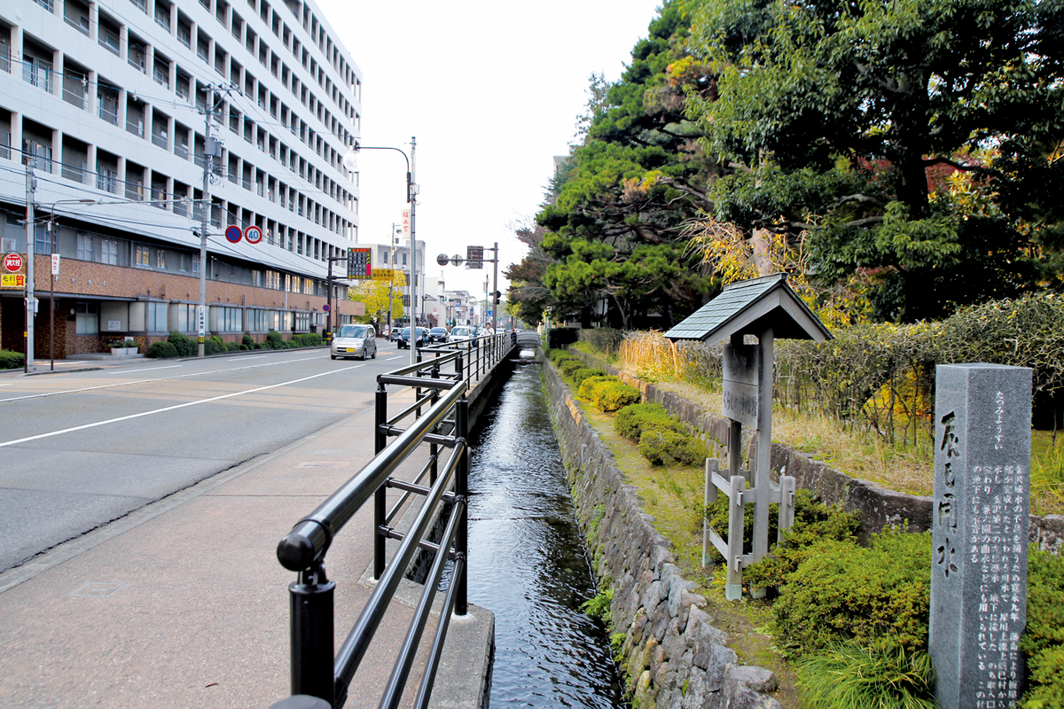
In 1632, following a major fire the previous year, Lord Maeda Toshitsune ordered the construction of a waterway by diverting water from the river to the castle. Along with Tamagawa Aqueduct in Tokyo and the Hakone Canal in eastern Shizuoka Prefecture, this waterway is one of the oldest in Japan. The winding streams of Kenrokuen are supplied from the Tatsumi Waterway. An almost unchanged 8.7 km section of the full 11 km waterway from the Kami-Tatsumi-machi sluice gate to Kenrokuen was made a National Historic Site in 2010.