Historical map American Expeditionary Force
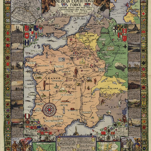
Insets: Plan of the city of Paris -- From home ports to war zone -- The Meuse-Argonne drive -- The St. Mihiel salient. Includes textual material : High points of the world conflict--The path of war. Includes graph and color illustrations, including map border consisting of badges of the combat divisions.
すべてのスポット情報
0件のスポット