サイゴン (1970年)
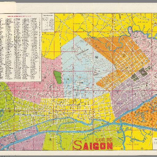
ベトナム戦争時の南ベトナム共和国のサイゴン市(現、ベトナム社会主義共和国ホーチミン市)の市街図<br><br> Pocket map sheet 43x60, folded into pictorial cover 12.5x8. Shows 11 districts, street. parks, rivers Landmarks and tourist attraction. Includes compass rose oriented with north toward the upper right, legend, list of the 11 districts and alphabetical index to places on the map. On verso: Tourist information in English and Vietnamese.
すべてのスポット情報
0件のスポット