World Map, 1932
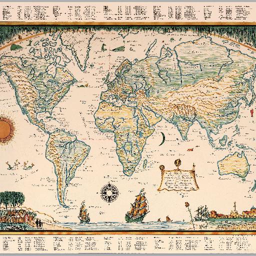
Hand colored outline pictorial map of the world on Mercator projections. Relief shown pictorially. Showing sun and moon in left and center of map, Compass rose on lower center. Statistical tables above and bottom of the map. Title provided by cataloger. Copyright, 1932. by Hendrik Willem Van Loom. "This map of the world is drawn according to the projection of Gerard Kremer of Gerardus Mercator, by his good neighbor. Thanks, Hendrik Van Loom".
All spots information
0 spots