Africa, 1740
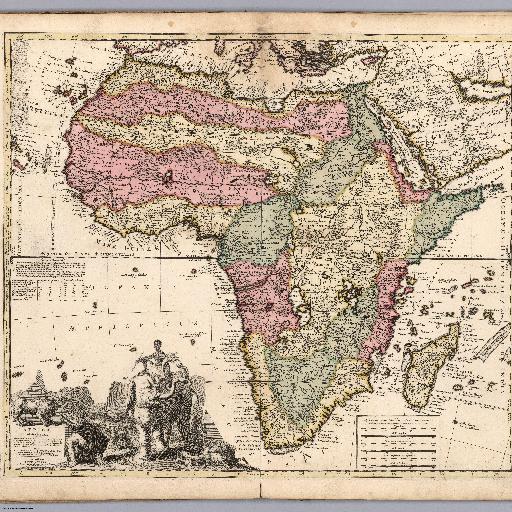
Engraved hand colored in outline map of Africa with decorative cartouche, table and text. Published by A. F. Zuerner, printed by P. Schenk. Shows political boundaries, cities, towns, rivers and mountains. Relief shown pictorially.<br><br> Reference:<br> https://www.davidrumsey.com/luna/servlet/detail/RUMSEY~8~1~297670~90069381:Africae-in-Tabula-Geographica-Delin?sort=pub_list_no_initialsort%2Cpub_date%2Cpub_list_no%2Cseries_no&qvq=q:africa;sort:pub_list_no_initialsort%2Cpub_date%2Cpub_list_no%2Cseries_no;lc:RUMSEY~8~1&mi=16&trs=5211
All spots information
0 spots