Indochina, 1954
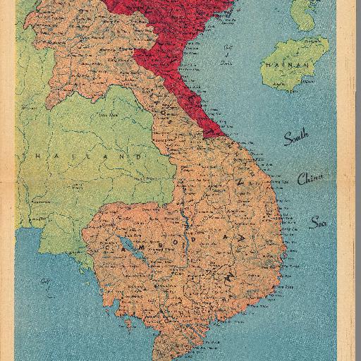
Color map, with descriptive text. Shows political and administrative divisions, place names and distances. Relief shown by shadings.<br> Reference:<br> https://www.davidrumsey.com/luna/servlet/detail/RUMSEY~8~1~294539~90065350:Indochina---The-partition-at-Geneva?sort=Pub_List_No_InitialSort%2CPub_Date%2CPub_List_No%2CSeries_No&qvq=q:indochina;sort:Pub_List_No_InitialSort%2CPub_Date%2CPub_List_No%2CSeries_No;lc:RUMSEY~8~1&mi=4&trs=18
All spots information
9 spots