Stroly

Versailles (1844)

Versailles (1844)

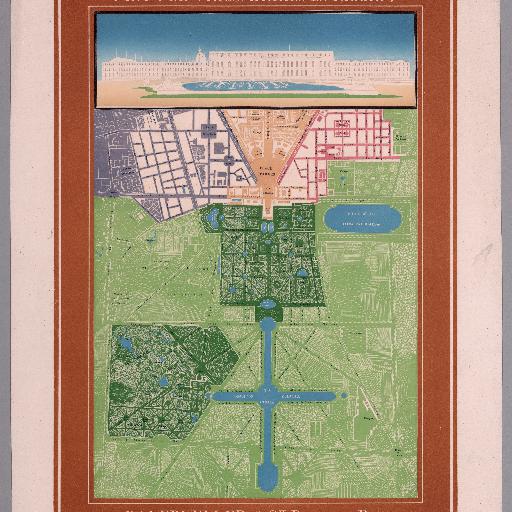
Date estimated. Embossed chromolithograph plan printed in color. Little is known about the Bauerkeller cartographic publishing firm. Headed by Georg Bauerkeller, they were apparently based in Darmstadt, Germany, just south of Frankfurt, but also maintained an office in Paris. They were active for about 30 years from the 1830s through the 1860s, and produced maps, plans, and small atlases. They are best known for the maps they produced using the 'geomontographie' - the process employed in the production of the present map.

StrolyPosted byStrolyUpdated:
View this map

All spots information

10 spots

Unnamed CategoryUnnamed Category

Hall of Mirrors

Unnamed Category

pointOpen

No description available

Gallery of Battles

Unnamed Category

pointOpen

No description available

Royal Chapel

Unnamed Category

pointOpen

No description available

Royal Opera

Unnamed Category

pointOpen

No description available

Hameau de la Reine

Unnamed Category

pointOpen

No description available

Versailles Orangerie

Unnamed Category

pointOpen

No description available

La Lanterne

Unnamed Category

pointOpen

No description available

Grand Trianon

Unnamed Category

pointOpen

No description available

Petit Trianon

Unnamed Category

pointOpen

No description available

Palace of Versailles

Unnamed Category

pointOpen

No description available